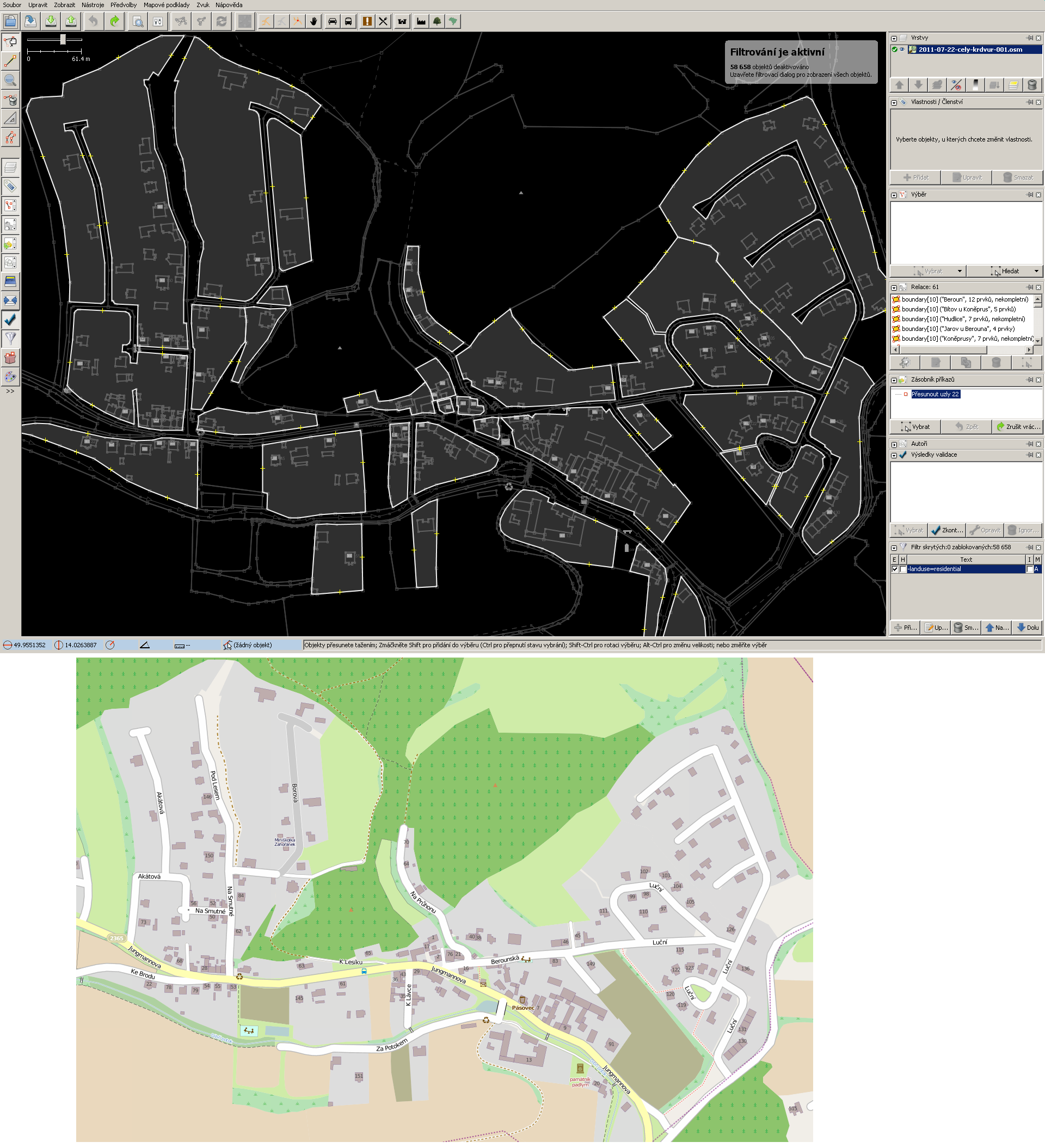
Hello, I'm trying to map our village Zahorany u Berouna (Czech Republic) and I have question about correct use of landuse=residential with mapping towns/villages. I'm new here. I red base conventions and Tag:landuse=residential and something about snapping polygons to highways. I mapping this from Czech land parcel data (source=cuzk:km) so I'm mapping it on new nodes along the parcel edges (same recommendation I get on Czech Mailing-list). This is clear for me (not a subject of my question). By this I mapped each consistent residential block separately by accurate land parcel data edges (each residental block divided by some place, street, scrub, grass, green etc. have own polygon). Between this polygon I mapped other landuse (eventually natural) polygons e. g. grass, scrub, reservoir (pond), playground, village green, greenfield, garden (for creating detailed map of village). Dividing landuse=residential to individual blocks By this way I can map areas between residential blocks without its overlapping other polygons (especially other landuse polygons) - I red some basic topological rules and it's not allowed to overlap polygons especially with same tagtype - e. g. landuse with landuse. JOSM screenshot with filtered landuse=residential But I don't know if this mapping of landuse=residential is correct especially its dividing by separeate blocks and mapping by parcel egdes. Is this way correct or incorrect and it will be better have one big polygon for all this area (on screeenshot) and in some smaller areas overlapped with other landuse (grass, reservoir, playground, school, garden, park) or some natural=scrub etc. in areas where residential blocks are interrupt by some other places or highways. Thanks for answers and I'm sorry for my bad english. asked 23 Jul '11, 09:33 Pavel Bokr edited 23 Jul '11, 15:36 |
3 Answers:
Think of This means that one would not normally use Personally I don't see a problem with a smaller area (e.g. answered 23 Jul '11, 11:57 Frederik Ramm ♦ |
I don't see any problems with mapping in this way. Whether to snap landuse polygons to highways is up to you, most mapping near me does not snap the polygons to highways. In the UK there are quite a lot of places where some overlap is used with a big residential area and then smaller places like grass, cemetery, recreation_ground are done with overlapping landuse. Having a partial overlap is bad though, the smaller landuse areas are basically like implicit multipolygons. So your mapping looks great, I would continue in the same way. answered 23 Jul '11, 11:05 quantumstate |
Most users do not recommend joining landuse and highway nodes and ways, I think even keep right did complain about it, but I cannot see any errors in your mapped area related to landuse although there are a lot of other errors in the surrounding which you may want to fix. answered 23 Jul '11, 13:41 scai ♦ |
Thank for answer! So on this example http://osm.kraluvdvur.cz/osm-zahorany-landuse-residential-mapping.png is about range of residential area correct part A and part B is incorrect???
Then I don't know why recommendation for accurate mapping about land parcel data edges before roads (if is available) if residential area is considered widely generaly with roads and others areas.
If B on my image is wrong I can make correction to A and try to use multipolygon e. g. for farmland in the village etc.
So what have I do?
But I'm little confused from various recommendation which are mutually partly inconsistent and I don't find some detailed recommendation or detailed best practice examples (wiki is little short for this) - if is something about this or some good examples please give me a link.
If B (image link in comment above) is wrong I think it will be good this geometry use for barriers=fence to draw closed area for walking-through the mapped area.
Neither A nor B are wrong. Both validly define residential areas, B is just a little more detailed but this level of detail is not required. If you want to map it this way, do it. Some people like it, some may say it is an unnecessary level of detail. But in the end all depends on the use case scenario of the data.
In my opinion, B is very close to "wrong" because a residential road is certainly part of a "residential area", whereas B goes through a lot of effort to exclude the road from the residential area. This is more than "unnecessary detail"; it is misleading detail that helps nobody.
Thank You! I Will try some compromise probably with multipolygon (maybe with https://wiki.openstreetmap.org/wiki/Relation:multipolygon#Two_disjunct_outer_rings too) to include residential roads to adjacent residental area and concurrently to try minimize overlaps landuse residental with other landuse or other polygons (so maybe exclude areas around playground, green by the stream and by the teriary highway etc).
For me was misleading especially recommendation about not connecting landuse residental to roads and creating paralel edge if detailed parcel data is available. Thanks for explanation!