NOTICE: help.openstreetmap.org is no longer in use from 1st March 2024. Please use the OpenStreetMap Community Forum

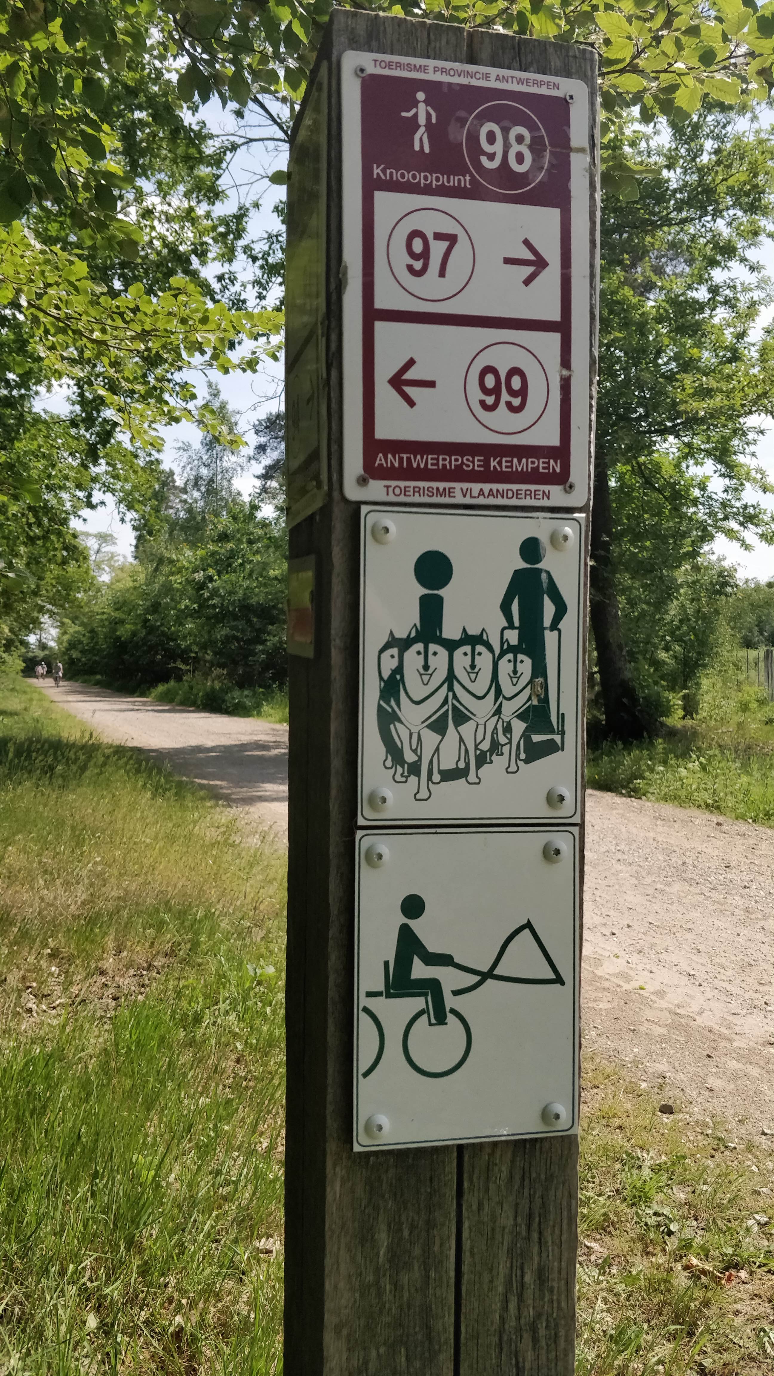
Which access tags should I use on roads with the following signs ? The dogs are pulling a carriage, not a sledge, as we typically do not have enough snow.

alt text

asked 23 May '18, 08:22

escada's gravatar image

escada
19.0k16166302
accept rate: 21%

What is the bottom one anyway... bikesurfing?

(23 May '18, 08:51) Frederik Ramm ♦
1

Looks like a horse-drawn coach. Anyway, are these access signs? I.e. do they really define the legal access of this way? Or do they just indicate some local routes?

(23 May '18, 09:03) scai ♦

They are used by the agency that is responsible for all forests in Belgium, the full list can be found on the website of Natuur en Bos

And indeed the bottom one is a very stylized horse pulling a coach

(23 May '18, 09:17) escada

In England and Wales, the legal restrictions on "restricted byway" are pretty similar to your sign (though @scai's point is a good one to see if yours are actually legal restrictions or just "be aware of what you might find here"). I typically tag restricted byways as something like "motor_vehicle=no;vehicle=yes; foot=yes;horse=yes;bicycle=yes".

permanent link

answered 23 May '18, 09:31

SomeoneElse's gravatar image

SomeoneElse ♦
36.9k71370866
accept rate: 16%

edited 23 May '18, 09:32

1

there is actually a different sign for horses and for horses pulling a coach.

They are legal restrictions, more info (in Dutch) on the website of Natuur en bos.

(23 May '18, 10:28) escada

Follow this question

By Email:

Once you sign in you will be able to subscribe for any updates here

By RSS:

Answers

Answers and Comments

Markdown Basics

  • *italic* or _italic_
  • **bold** or __bold__
  • link:[text](http://url.com/ "title")
  • image?![alt text](/path/img.jpg "title")
  • numbered list: 1. Foo 2. Bar
  • to add a line break simply add two spaces to where you would like the new line to be.
  • basic HTML tags are also supported

Question tags:

×930
×98

question asked: 23 May '18, 08:22

question was seen: 1,771 times

last updated: 23 May '18, 10:28

NOTICE: help.openstreetmap.org is no longer in use from 1st March 2024. Please use the OpenStreetMap Community Forum