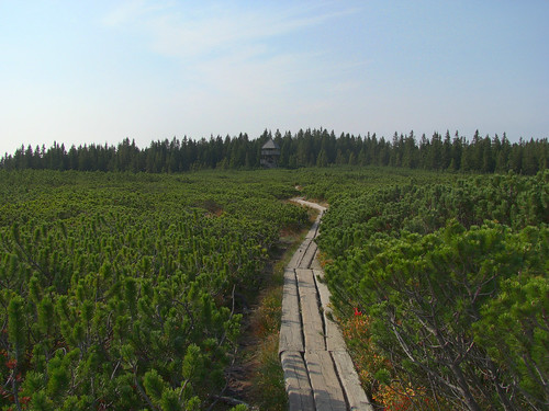
How do you tag a path over a marshy area that is made of wood logs? Example:
asked 23 Sep '10, 10:14 Breki |
2 Answers:
There is tag bridge=boardwalk. https://wiki.openstreetmap.org/wiki/Tag:bridge=boardwalk answered 09 Apr '18, 14:39 sookoll |
You use the regular highway tag as usual as the highway tag describes the importance of the highway and not the quality. To tag that the surface of the path is of wood you use surface=wood. answered 23 Sep '10, 10:43 Gnonthgol ♦ Could you show a full example of highway=path crossing a wetland? I do get warnings about highway is crossing a water area. Should the path have layer=1? (19 Dec '21, 07:42) Msiipola |
The "bridge" tag feels wrong. Is it fine to use this for a long wooden trail, not a bridge?
@inkatlas: it's quite a long standing convention, and many boardwalks are constructed in similar ways to bridges. We'd probably do as well with footway=boardwalk with surface=wood/plastic/... (yes, they are not all wood) and optional bridge tag depending on structure.
I'm not sure if the older UK term "duckboard" is used anywhere on OSM.
It may be time to have a proper discussion, the usual venue is the tagging list.