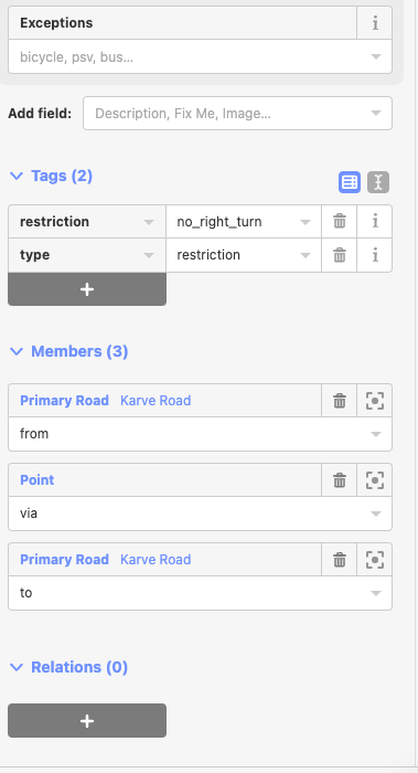
I want to correct incorrect/invalid turn restrictions. I can find them using osmose, but I can't figure out how to edit/correct them in ID editor. Lets take this relation as an example: https://www.openstreetmap.org/relation/11272427#map=19/18.51456/73.84239 The issue is that the via element is a node, when it should have been a way. When I navigate to the relation in ID editor, I see this:
I can't figure out how to modify or add new member to the relation. How do I edit such incorrect turn restrictions in Id Editor ? asked 28 Oct '22, 14:15 Devdatta edited 28 Oct '22, 14:16 |
One Answer:
Generally speaking relations in iD editor are somewhat backwards. Instead of selecting the relation and then adding members you have to select the intended member and then add the relation to it. It can get really confusing with multiple relations with identical descriptions nearby. For turn restrictions in particular though iD has a really nice purpose built mini-editor built in. I don't know if it will work with your "invalid" one though. To activate this you need to select an intersection node. A small map of the junction will appear at the left and you can then select the incoming ways to see to the corresponding outgoing restrictions. The in-app help explains things better one the turn restriction mode is active. answered 29 Oct '22, 11:09 InsertUser edited 29 Oct '22, 11:13 |


Reading passed questions may help you https://help.openstreetmap.org/search/?csrfmiddlewaretoken=VqIDw7qIfNPQjh9rkJGFCrcI94LMWJAR&q=turn+restrictions&Submit=search&t=question