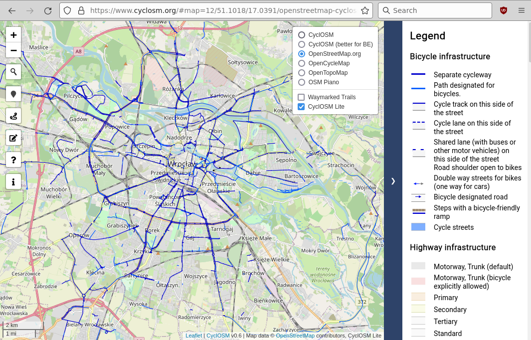
My favourite online bicycle map is: standard OSM background (Mapnik?) + "CyclOSM lite" transparent layer. It has bright bicycle infrastructure, even for zoom = 11. For example, https://www.cyclosm.org/#map=12/51.1018/17.0391/openstreetmap-cyclosmlite : When I ride a bicycle, I use Android smartphone + OsmAnd app, with Cycling profile and map style "OsmAnd". But I see bicycle infrastructure only for a limited amount of zoom levels, and even then the infrastructure is not highlighted. Probably, I have to create a custom rendering style, based on asked 05 Jun '22, 20:36 Vazhnov Alexey |
One Answer:
You can try a different map style (Configure map / Map style). Touring and Topo style are good for viewing bicycle infrastructure. It also helps to turn on rendering of bicycle routes (Configure map / Cycle routes). answered 07 Jun '22, 10:24 scai ♦ |
I've already enabled bicycle routes (thanks to joost schouppe in https://help.openstreetmap.org/questions/44132/open-cycle-map ), but in my opinion bicycle route is not a bicycle infrastructure. At least here in Wrocław (Poland), a lot of routes are going through ground tracks and plain roads.
Touring style is better than the default style OsmAnd, thank you! At least I can see bicycle roads better at zoom level "1 km". With a default OsmAnd style, bicycle roads are barely visible at zoom level "1 km". But no highlighted bicycle roads at zoom level "2 km" and higher, in comparision with CyclOSM lite (see the screenshot).
This zoom-level related behavior is defined in the corresponding rendering stylesheet located in the OsmAnd directory at rendering/*.render.xml. You either have to change this file yourself or create a ticket at https://github.com/osmandapp/OsmAnd/issues in hope that someone else will do it.