NOTICE: help.openstreetmap.org is no longer in use from 1st March 2024. Please use the OpenStreetMap Community Forum

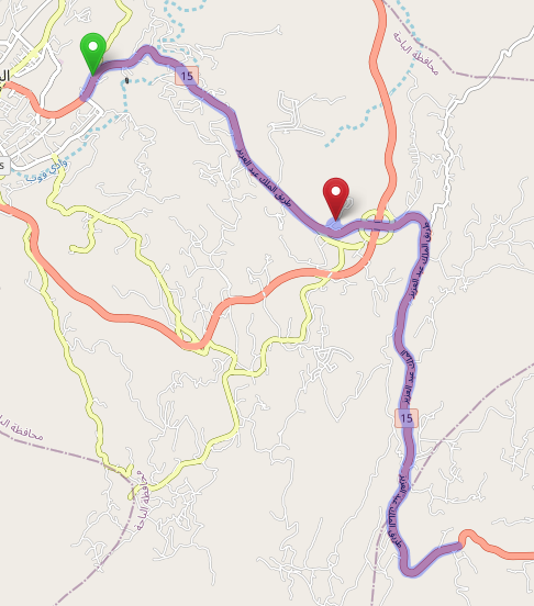
When generating a route the server is not using the off-ramps to make a u-turn but rather moving all the way down the highway which causes the route to be much longer than what is possible. See here

https://www.openstreetmap.org/directions?engine=fossgis_osrm_car&route=20.0135%2C41.4811%3B19.9922%2C41.5190#map=13/19.9762/41.5221

alt text

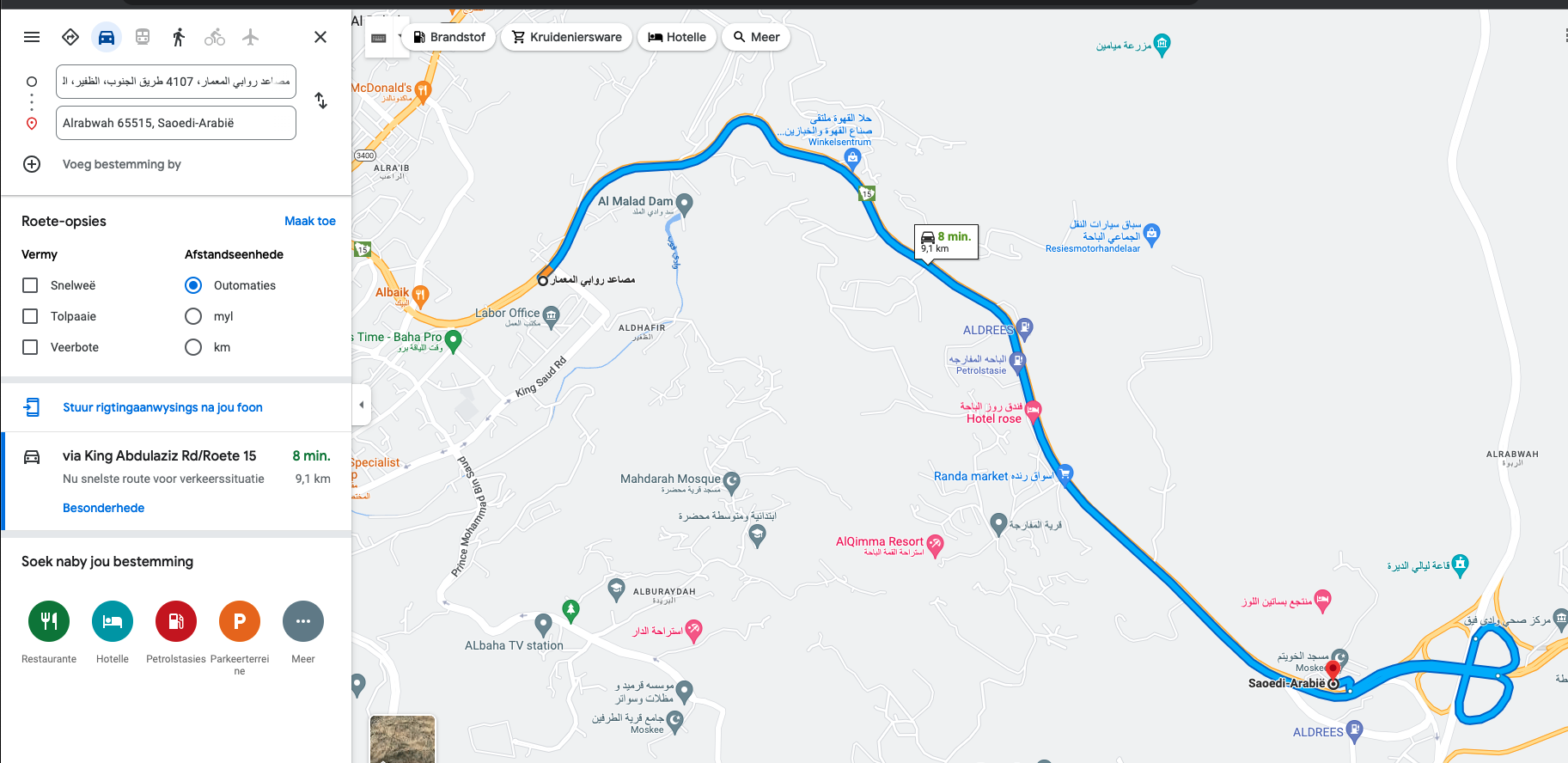
Whereas in Google Maps you get this https://www.google.co.za/maps/dir/20.0100%0941.4795/19.9910%0941.5190/@20.0041348,41.4936417,15z/data=!4m10!4m9!1m3!2m2!1d41.4795!2d20.01!1m3!2m2!1d41.519!2d19.991!3e0

alt text

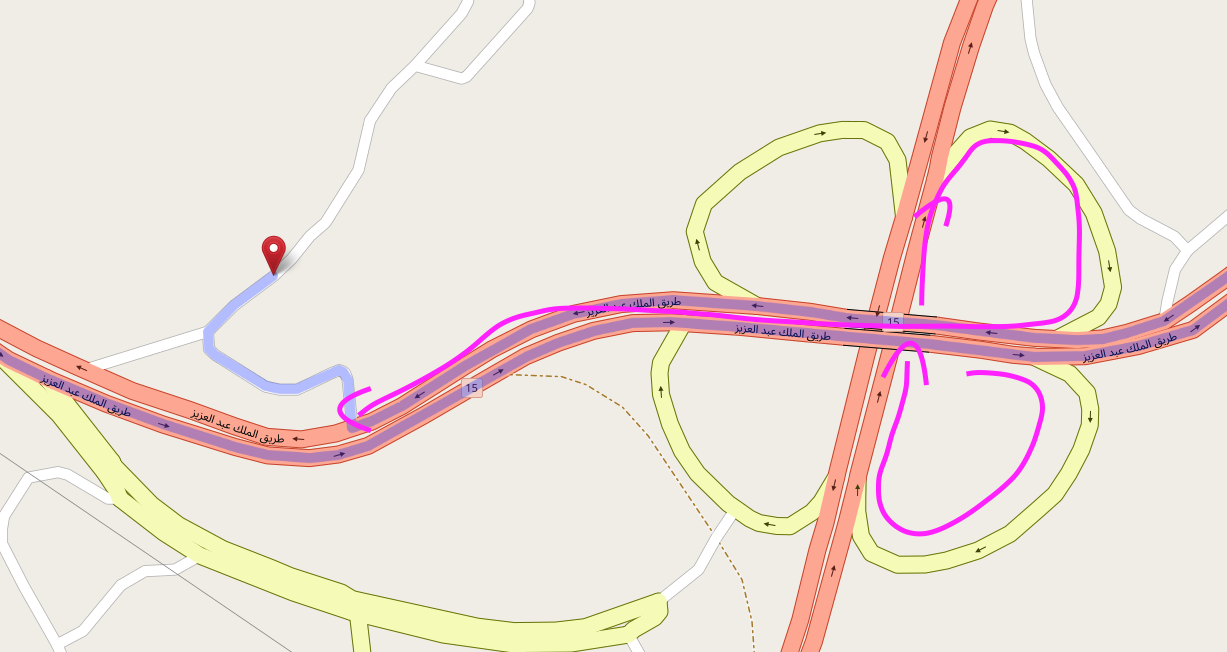
The routing server is not making use of the off-ramps

alt text

I am using OSM server for routing inside an application that is calculating distances by route. Any suggestions on how this can be fixed?

asked 19 May '22, 08:27

Jaco-Ben's gravatar image

Jaco-Ben
16112
accept rate: 0%


The North/South Trunk road is tagged with construction=trunk. I guess OSRM is avoiding that road because of that. Please remove that tag from all the segments of that road that have been opened to traffic.

permanent link

answered 19 May '22, 10:48

TZorn's gravatar image

TZorn
12.3k764225
accept rate: 15%

I downloaded this pbf file https://download.geofabrik.de/asia/gcc-states.html, created my own custom routing graph and now the issue is not reproducible.

(20 May '22, 13:03) Jaco-Ben

Spot on. I only wanted to add: use the debug map to find which way might be the culprit. It is not linked from openstreetmap.org, but using routing.openstreetmap.de you will find it: https://routing.openstreetmap.de/debug/car.html#16/19.9928/41.5196

(21 May '22, 17:11) datendelphin

Follow this question

By Email:

Once you sign in you will be able to subscribe for any updates here

By RSS:

Answers

Answers and Comments

Markdown Basics

  • *italic* or _italic_
  • **bold** or __bold__
  • link:[text](http://url.com/ "title")
  • image?![alt text](/path/img.jpg "title")
  • numbered list: 1. Foo 2. Bar
  • to add a line break simply add two spaces to where you would like the new line to be.
  • basic HTML tags are also supported

Question tags:

×305

question asked: 19 May '22, 08:27

question was seen: 987 times

last updated: 21 May '22, 17:11

NOTICE: help.openstreetmap.org is no longer in use from 1st March 2024. Please use the OpenStreetMap Community Forum