It's ridiculous. Strange Polygons of "woods" blot the map . Sure, most of Canada is indeed forest including many suburban areas but it's not mapping to paint arbitrary patches of green. Natural forest isn't a "feature" It obscures the trails,roads,powerlines rivers creeks hamlets etc that are mappable features. These polygons are anyways innacurate. Satellite maps show the logging that goes on. https://www.openstreetmap.org/#map=13/49.3590/-124.6924 https://www.openstreetmap.org/#map=10/50.1232/-125.4474 I'd be happy to delete the offenders but I don't know how. asked 25 Apr '22, 23:46 silverwing |
4 Answers:
The blotchy mapping of forests in Canada has been a longstanding issue. Most of this is due to incomplete imports of CANVEC data over the years. On Vancouver Island, there's one contributor who did some forest mapping, but it certainly wasn't done in an ideal manner and I've been slowly working on cleaning things up. Most of these areas are indeed covered almost entirely by forest (or more specifically, natural=wood), so I don't think wholesale deletion would be the best way forward. It would be better to add decently-mapped forests in the surrounding areas to dilute the blotchiness. As for obscuring other features, I'm not aware of that happening on the Standard OSM rendering. All of the objects you listed should be visible on top of the forest areas. answered 26 Apr '22, 00:43 alester |
I think many of the rendering choices would be improved with less "colouring in". In my area of Eastern England we have a lot of brown farmland ( would never map) which hide footpaths and if printed use a lot of ink and poor contrast. I would like a rendering that is mainly white. Many commercial maps have taken the choice to hatch ( parallel angle lines) or multiple small symbols of tree types or tufts of grass to convey information without over colouring their maps. Two examples of styles I like are GB Ordnance Survey NPE and newer ones and some Old Russian military maps that I have seen online. I realise we could learn how render our own maps.. I haven't got that far yet. For copyright reason I can't print an example here. I think opentopomap is a little clearer than our standard rendering. https://opentopomap.org/#map=10/45.4124/-75.1657 answered 26 Apr '22, 10:49 andy mackey edited 26 Apr '22, 13:36 |
....But apparently the painted polygons are actually Private forest lands . From my examples it's nonsensical "painting" private leases as "woods" while not painting the Crown Lands or even Strathcona Park. I shouldn't say trails and creeks are "obscured" but they are certainly reduced in clarity. Andy Mackey's example above (north of Ottawa, Canada) is a topographic example from OpenTopoMap (not Open Street Map) is a less objectionable rendering in his example area,and is likely using NRC (canvec) sources but need say, in my area of British Columbia (https://opentopomap.org/#map=11/49.6683/-125.2489) it's still wrong because it's apparently vacuumed up the same error. I have the NRC (National Resource Canada) topos (viewable on Toporama) and they do not contain these particular polygons. Forest is represented but one who really cares about the exact forest would do well to check the date of the source or goto satellite maps.... answered 26 Apr '22, 17:48 silverwing opentopomap is uses openstreetmap data. click on "about" on the opentopomap page. (26 Apr '22, 20:32) andy mackey (26 Apr '22, 20:34) andy mackey 1 The areas that have been mapped as natural=wood on Vancouver Island don't correspond directly to either private or crown lands. It's just those are the only areas where contributors have mapped the forest. Parts of Strathcona Park aren't "painted" simply because nobody has gotten around to mapping the forests there. It should also be noted that the primary goals of the "Standard" OSM rendering are to show an example of what can be done with the OSM data, and to act as an aid to mappers. The maintainers of that style do try to keep things "looking good" as much as they can, but it isn't intended to be a polished, end user-ready product. (27 Apr '22, 17:56) alester |
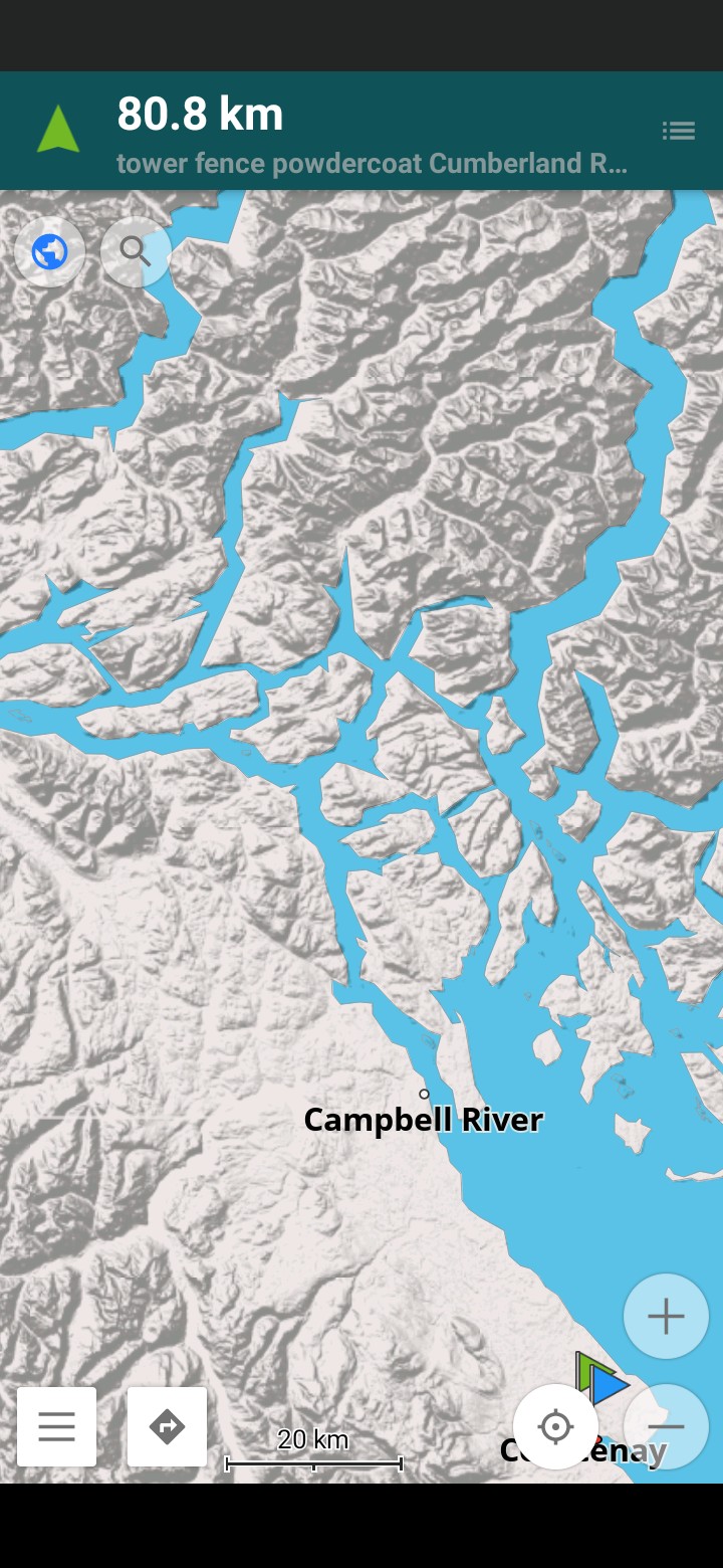
I suppose...Perhaps it's too bad that the navigation apps that use it don't do some filtering on their own. OsmAnd is the only one I know that makes an effort, by allowing hiding of polygons, but that tends to sink islands in the blue at certain zooms... To me it looks better and plainer if I get rid of the "woods" tag and doesn't hurt anything else I can see. But thanks for your responses. (Here's an osmand screengrab same area from OsmAnd..I forgot to turn the shading off as a fairer comparison to the area I linked above
answered 01 May '22, 01:09 silverwing |
Andey, you are right about the "rendering" and "styles"...I've been fiddling with OsmAnd's rendering files and they are certainly something you might like to try...much the easiest way for home users if their mapping application includes the option of configureable files... The maps themselves can be edited from a local download too, but they are hard to rebuild as maps an application can use in anything beyond a few square miles..It wants more horsepower than i have, anyways.
It's really easy for someone to get stuff onto the OSM but difficult to get it off.