NOTICE: help.openstreetmap.org is no longer in use from 1st March 2024. Please use the OpenStreetMap Community Forum

How should extended fields of boulders (blockfields and similar formations) be tagged? A prominent example would be the so-called "Felsenmeer" (stone sea) in the Odenwald region in Germany, but you can find such fields at a smaller scale in many other places.

Possible tags and why they don't really work:

  • The aforementioned "Felsenmeer" is currently tagged as natural=bare_rock, but looking at the description and examples in the wiki, that seems to be more apt for contiguous rocky surfaces connected to the ground, not loose rocks. I'm also not sure if it can be called "bedrock" in such cases (as the bare_rock description requires).
  • natural=stone is for an individual boulder.
  • natural=rock allows groups but they have to be connected to the underlying bedrock (not the case here).
  • natural=scree requires the stones to be angular (not the case here) and to have been accumulated "by rockfall from adjacent rockfaces".
  • natural=shingle requires deposition and shaping by water transport (not necessarily the case).

Is there another tag for this that would fit better or am I missing something else?

asked 27 Mar '22, 18:02

smheidrich's gravatar image

smheidrich
26114
accept rate: 0%

edited 30 Mar '22, 11:19


There is very limited usage of [natural=boulder_field][1] (a couple by me, but there are other contributors using the tag). Boulder fields may be created through a number of mechanisms: (geologically) recent massive rock fall; peri-glacial frost heave breaking up bare rock (good examples in Pennsylvania); some raised beaches lifted by isostasy (Sweden).

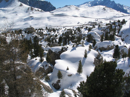
Città dei Sassi, an example of a field of massive boulders

Specific examples of the phenomenon (not necessarily mapped as such):

  • Above Vals in Graubunden. Geological origin unknown. Probably good habitat for Rock Partridge.
  • Città dei Sassi near the Sella Pass. This is mapped as scree, but this is clearly incorrect, some of the boulders are house sized. Origins as a Bergsturz from the E flank of the Langkofel.
  • Chalamain Gap in the Cairngorms. A glacial overflow channel with large boulder blocks. (again mapped as scree).
  • Goldauer Bergsturz. In the wooded areas on the debris of the 1806 rock fall there are numerous very large boulders with the field extending beyond the railway line towards the Lauzersee
permanent link

answered 01 Apr '22, 23:42

SK53's gravatar image

SK53 ♦
28.1k48268433
accept rate: 22%

edited 02 Apr '22, 13:25

This recently came up in another forum and I did some checking between what's posted here and there. Similar references to Felsenmeer and terrain such as that. Short answer is natural=blockfield.

permanent link

answered 24 Jan, 04:45

cactolith's gravatar image

cactolith
26
accept rate: 0%

Follow this question

By Email:

Once you sign in you will be able to subscribe for any updates here

By RSS:

Answers

Answers and Comments

Markdown Basics

  • *italic* or _italic_
  • **bold** or __bold__
  • link:[text](http://url.com/ "title")
  • image?![alt text](/path/img.jpg "title")
  • numbered list: 1. Foo 2. Bar
  • to add a line break simply add two spaces to where you would like the new line to be.
  • basic HTML tags are also supported

Question tags:

×191
×4
×4
×3
×3

question asked: 27 Mar '22, 18:02

question was seen: 1,663 times

last updated: 24 Jan, 04:45

NOTICE: help.openstreetmap.org is no longer in use from 1st March 2024. Please use the OpenStreetMap Community Forum