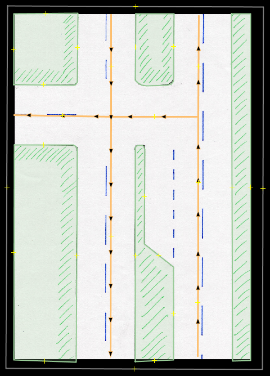
Ciclovía is a concept created in Bogotá, Colombia in the 80s, where some normal streets are temporary blocked for cars to only allow bikes and pedestrians to go there. This only happens on Sundays mornings. In order to allow reduced traffic, there are detours, shared highways (dedicated lanes), and other changes. We have created a project to map all of these conditions, initially in Bogota. This is the wiki documentation of the project. As part of the project, we identified several restrictions and detours cases. Here is the issue of case 9a (which is very similar to case 9 and 10). This is the normal behavior of the highway:
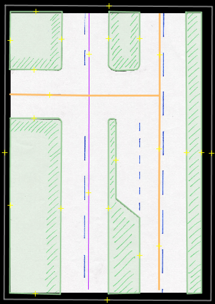
The mapping is simple, one highway goes up, the other goes down, and there is a turning lane, which is mapped in the a segment of the highway, with an extra lane as turning-lane. The horizontal highway is two-way. This is how it looks during ciclovía (I drew the ciclovía as cycleway just for the image):
As you can see, the right highway is both-ways; however, the turning lane is not next to the lane that goes up. This image describe the best the situation: https://www.mapillary.com/app/?pKey=439627097551960 How can we map this condition? Should I map the turning lane independently from the highway as a separated highway? This is a JOSM file to play with the highway and propose a solution. asked 23 Feb '22, 23:42 AngocA |
One Answer:
Hi. I guess mapping the turning lane separately is the only option. But I'm not sure I fully understand the question. Good luck with your project, it looks quite complicated. Regards. answered 24 Feb '22, 19:50 H_mlet |
I think the situation is almost the same as your standard case 9. It's just the road to the left that needs to be tagged differently.