NOTICE: help.openstreetmap.org is no longer in use from 1st March 2024. Please use the OpenStreetMap Community Forum

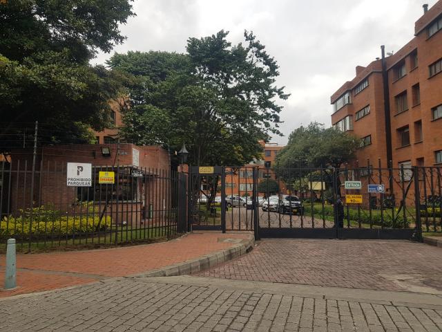
In Colombia, we call "conjunto cerrado" to a set of buildings or houses inside a barrier, with an only entrance area/door with a guardian. This could be called a condominium in English, but I wanted to explain before to prevent assumptions.

Well, those condominiums usually have internal highways that lead to parking spaces. I want to know how to exactly map them.

  • These highways are just like residential highways, but we use to map as residential the public highways that have associated names/ref; because these internal highways are private we are thinking of something else.
  • We also thought to tag them as living streets, but the same happens here. Living streets are public, with some legal stuff to call them like this, and the blue signal.
  • Last option is service, and we are currently using this, but not really sure. The definition says these are for driveways, alleys, or parking, but none of the examples really fit in the definition of highways inside a "Conjunto cerrado".

There is a current discussion around this, and I would like to see what other mappers think or propose to standardize the mapping in Colombia. The examples proposed here also does not fit our issue.

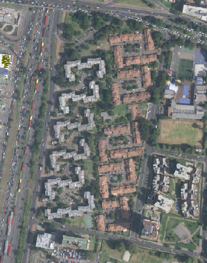
Here is an example of those internal highways.

alt text

alt text

asked 05 Feb '22, 04:39

AngocA's gravatar image

AngocA
281232433
accept rate: 0%

edited 05 Feb '22, 04:41


For larger gated communities where there are essentially a network of normal residential streets behind a gate the usual mapping would be to use highway=residential and add access=private/access=no or access=destination as appropriate.

In your example they look to me like highway=service with service=parking_aisle and access=private/access=no or access=destination as appropriate. The barrier=gate can be mapped as well as a point on the highway, again with the appropriate access tag.

permanent link

answered 05 Feb '22, 07:59

InsertUser's gravatar image

InsertUser
11.0k1369185
accept rate: 19%

edited 05 Feb '22, 08:06

Follow this question

By Email:

Once you sign in you will be able to subscribe for any updates here

By RSS:

Answers

Answers and Comments

Markdown Basics

  • *italic* or _italic_
  • **bold** or __bold__
  • link:[text](http://url.com/ "title")
  • image?![alt text](/path/img.jpg "title")
  • numbered list: 1. Foo 2. Bar
  • to add a line break simply add two spaces to where you would like the new line to be.
  • basic HTML tags are also supported

Question tags:

×163
×43

question asked: 05 Feb '22, 04:39

question was seen: 1,131 times

last updated: 05 Feb '22, 08:06

NOTICE: help.openstreetmap.org is no longer in use from 1st March 2024. Please use the OpenStreetMap Community Forum