NOTICE: help.openstreetmap.org is no longer in use from 1st March 2024. Please use the OpenStreetMap Community Forum

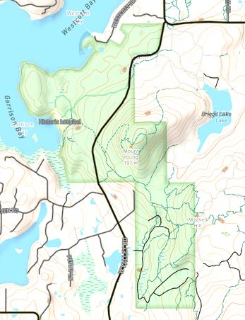
I'd like to upload ownership polygons. E.g. parks, conservation areas and distinguish the different agencies with color shading. I have shp files for the areas which I pulled from the county tax parcel data.

Is this possible without manually tracing the outlines?

example:

alt text

asked 10 Jan '22, 02:53

PacNWMike's gravatar image

PacNWMike
26224
accept rate: 0%


There are a number of issues with your request.

  1. In general, OSM is not interested in ownership or parcel data, especially when this information is not visible on the ground. (If there's a fence with a sign "XYZ property" then that's a different matter.) OSM might, however, be interested in areas that have a certain protection status or other characteristics that we do record.
  2. If such data is retrieved from a third-party source, the license situation must be checked. Probably not an issue in the US but best be safe, ensure that the source doesn't claim a copyright on the data.
  3. Simply uploading polygons leads to low-quality data, where the boundaries of neighboring areas (say, a state park and an Indian Reservation) overlap or leave little gaps when in reality one starts exactly where the other ends. Or, a state park ends exactly at the river, but because the river was traced from imagery and the state park imported, they don't line up or overlap in OSM. In the worst case, you'd be uploading an object that already exists in some form and you'd duplicate that. You would be expected to fix all these issues before uploading.
  4. Even if the data were in OSM, you wouldn't get to color-code it in OSM; you'd have to run your own renderer to define which kinds of areas to use which color for. And if you do (run your own renderer) then you might not have to get the data into OSM in the first place, you could just configure your renderer to read it from a shape file on disk. (Another option of drawing stuff on top of OSM, including ready-made third-party GeoJSON files, is the "umap" service on umap.openstreetmap.fr.)

See https://wiki.openstreetmap.org/wiki/Import/Guidelines for more on importing third-party data to OSM.

permanent link

answered 10 Jan '22, 09:09

Frederik%20Ramm's gravatar image

Frederik Ramm ♦
82.5k927201273
accept rate: 23%

edited 10 Jan '22, 09:12

Thanks for the response. It's all public domain so there shouldn't be any copyright issues. Very little of the public land has been added in our county. Exceptions being the State parks and National Park (example above). I would like to add several different ownerships. There are many. National Monument, National Wilderness, National Wildlife Refuge, BLM, State Natural Resources, Nature Conservancy, County Land Bank, Preservation Trust, etc. Quite a mish-mash. I could call them all PARKS but they would all show green and many share a common boundary. I can create the boundaries from GPX tracks derived from the tax parcel data and copy the area.

However I have all of the shp files from the various agencies which I thought would be easier. Not only the boundaries but also the roads and trails too.

(11 Jan '22, 03:55) PacNWMike

Follow this question

By Email:

Once you sign in you will be able to subscribe for any updates here

By RSS:

Answers

Answers and Comments

Markdown Basics

  • *italic* or _italic_
  • **bold** or __bold__
  • link:[text](http://url.com/ "title")
  • image?![alt text](/path/img.jpg "title")
  • numbered list: 1. Foo 2. Bar
  • to add a line break simply add two spaces to where you would like the new line to be.
  • basic HTML tags are also supported

Question tags:

×24
×9
×8

question asked: 10 Jan '22, 02:53

question was seen: 839 times

last updated: 11 Jan '22, 08:13

NOTICE: help.openstreetmap.org is no longer in use from 1st March 2024. Please use the OpenStreetMap Community Forum