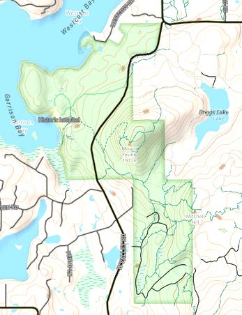
I'd like to upload ownership polygons. E.g. parks, conservation areas and distinguish the different agencies with color shading. I have shp files for the areas which I pulled from the county tax parcel data. Is this possible without manually tracing the outlines? example:
asked 10 Jan '22, 02:53 PacNWMike |
One Answer:
There are a number of issues with your request.
See https://wiki.openstreetmap.org/wiki/Import/Guidelines for more on importing third-party data to OSM. answered 10 Jan '22, 09:09 Frederik Ramm ♦ edited 10 Jan '22, 09:12 |


Thanks for the response. It's all public domain so there shouldn't be any copyright issues. Very little of the public land has been added in our county. Exceptions being the State parks and National Park (example above). I would like to add several different ownerships. There are many. National Monument, National Wilderness, National Wildlife Refuge, BLM, State Natural Resources, Nature Conservancy, County Land Bank, Preservation Trust, etc. Quite a mish-mash. I could call them all PARKS but they would all show green and many share a common boundary. I can create the boundaries from GPX tracks derived from the tax parcel data and copy the area.
However I have all of the shp files from the various agencies which I thought would be easier. Not only the boundaries but also the roads and trails too.