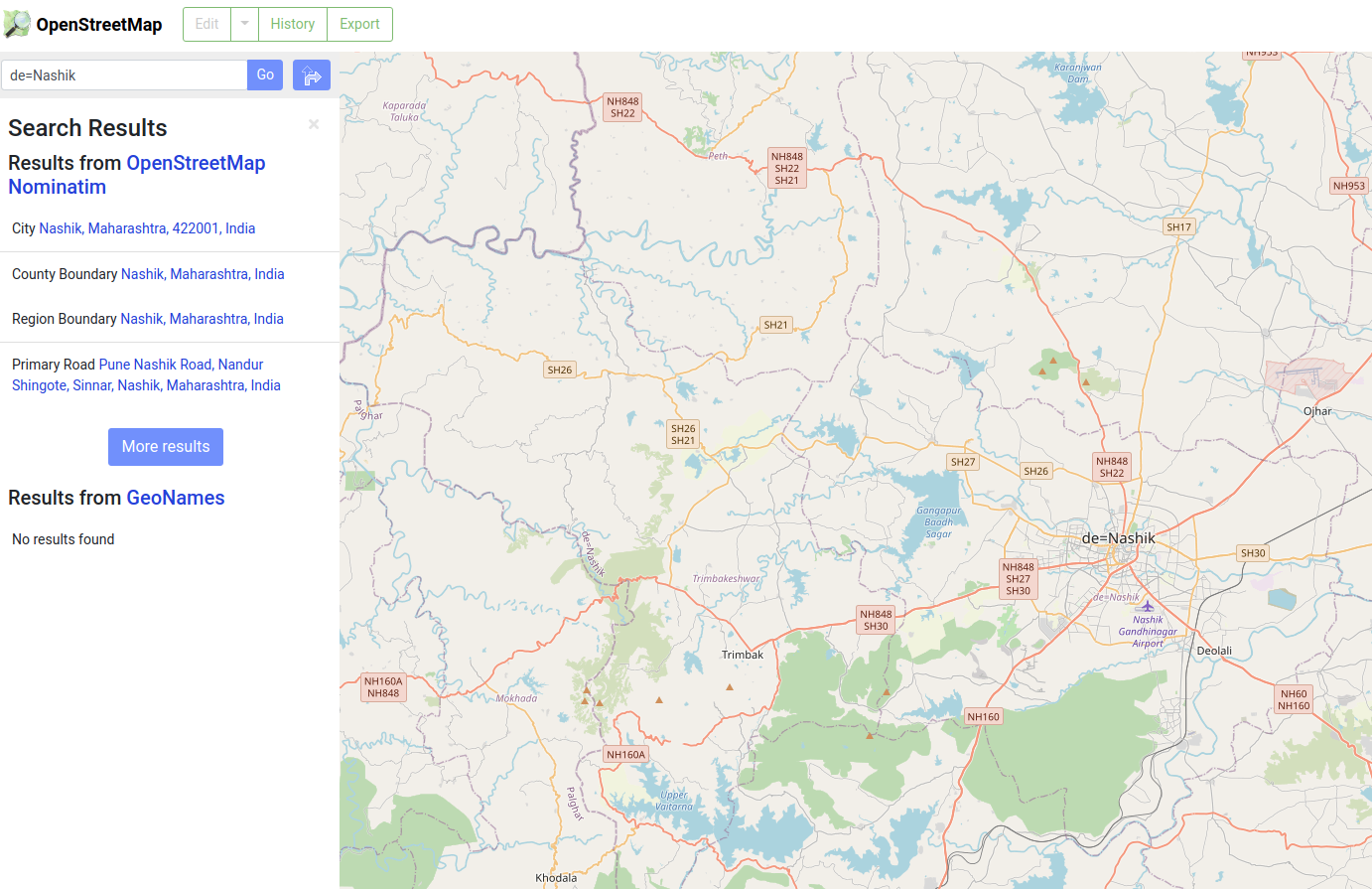
Hi, The name of the city of Nashik, India is spelled with a typo (it's currently 'de=Nashik', suggesting someone included the tag for German as part of its name in English) on some zoom levels of the map tiles that are served on openstreetmap.org. I edited the name in the admin relation 16 days ago, but I am still seeing it as de=Nashik for zoom levels 5-12 (see below). Apologies if this is due to me not understanding the data model, and what governs the display of place names. If one zooms in to level 13 it shows the name correctly. Once I zoom to the level where I can use ID to edit I can no longer find the typo. Asking for help identifying where this needs to be corrected. Thanks!
asked 23 Nov '21, 03:00 Alejandro |
One Answer:
Hi, There's nothing that needs correcting. You did indeed correct the name with your edit. More patience is needed waiting for tiles at all zoom levels to update. Regards. answered 23 Nov '21, 07:16 BCNorwich |
To clarify, low zoom tiles (that is up to zoom level 12) are not re-rendered on demand, but are instead processed at larger intervals in a batch fashion.