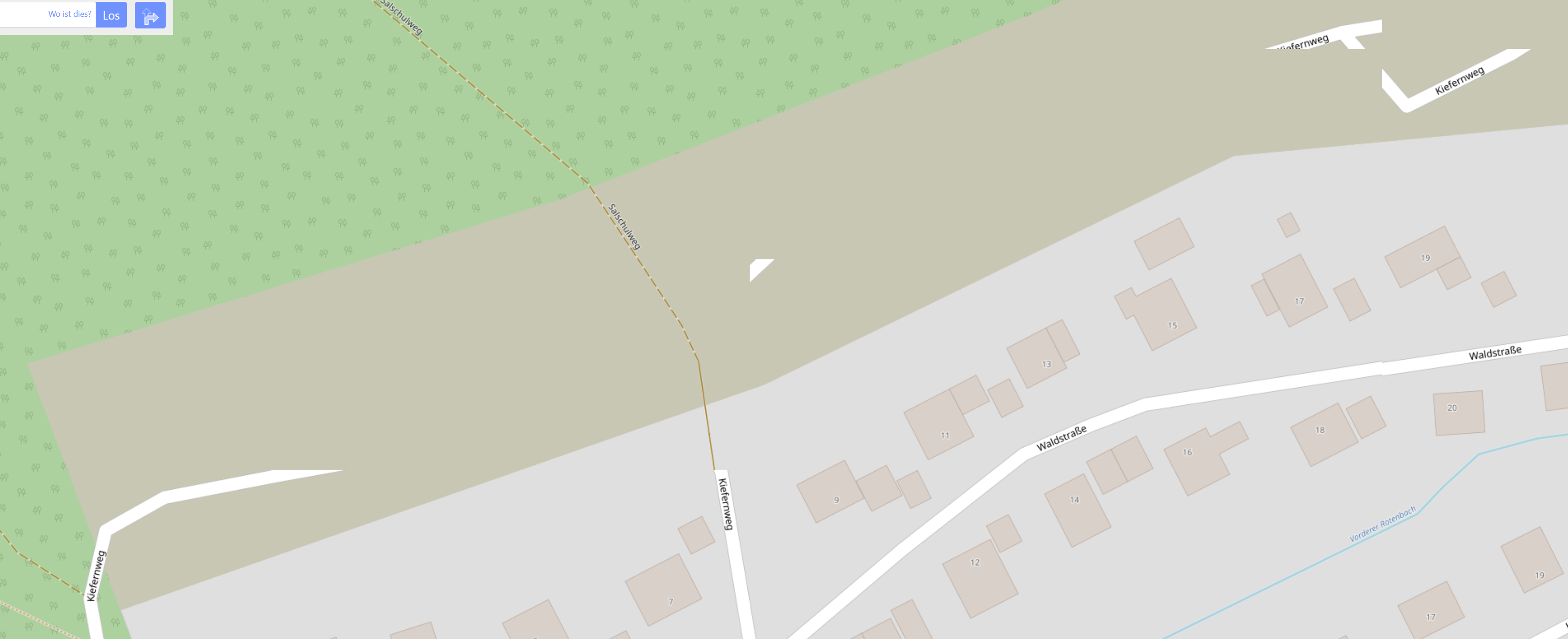
For the first time I decided to contribute to OSM by adding newly built road geometry. Mostly this is Germany, Oberreichenbach, Würzbach, road name Kiefernweg. Geometry was added through browser base on a GPS mapping last sunday (more than 3 days ago). These are the tree contributions I provided: However when I open OSM in the browser - any browser, also on a different computer - the newly added geometry is only partially displayed, depending on map scale. This is how it looks like:
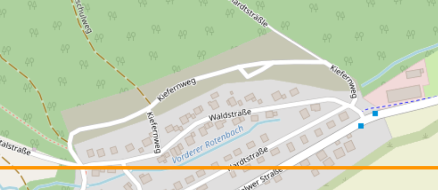
Nevertheless in the browser edit page it all looks fine. Routing services based on OSM show the same issues and seem not yet including the connectivity through the newly added links. This is how it is supposed to look like in a different map scale in OSM: To me it looks like the OSM tile update might not have worked, but I am not sure. Did I make a mistake? How to fix that, please? Help would be appreciated, thanks! asked 12 Aug '21, 10:15 MK0815 edited 12 Aug '21, 10:26 |
One Answer:
Hi MK0815, welcome to OpenStreetMap and thanks for contributing! On my side the new road is shown properly on all zoom levels. As you suspected it is probably a matter of some cache on the way to your browser still serving the old tiles. It will be solved over time. In the meantime you can try to reload the page without using the cache (possibly Ctrl+F5). The OSRM router on openstreetmap.org is also using the new road. Graphhopper probably still needs a day or two to also pick up the changes. No need to worry. On a side node: At least in Germany it seems to be consensus that the answered 12 Aug '21, 10:50 TZorn edited 12 Aug '21, 10:51 |
Hi TZorn,
thanks for your welcome and as well for providing the answer. And yes, this helped, I now as well can actually see the changes to be available :-)