NOTICE: help.openstreetmap.org is no longer in use from 1st March 2024. Please use the OpenStreetMap Community Forum

alt text

asked 02 Aug '21, 12:55

%E5%AE%AB%E6%9C%AC%E5%AE%87%E6%A3%AE's gravatar image

宫本宇森
31113
accept rate: 0%


There could be several reasons for this.

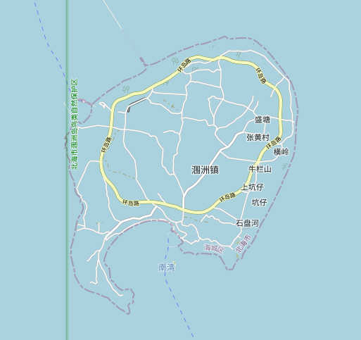
If this is in a lake, then it needs to be set as the inner boundary of the lake multipolygon. If if is not a multipolygon yet then it will need to be turned into one.

If this is in the ocean then it needs and unbroken sequence of ways with natural=coastline around the perimeter so that it has the land on the left side of the ways and ocean on the right. An error in this can break rendering. If the island is newly mapped then it may take a while for it to appear as coastline rendering is special and has a bit of a delay.

permanent link

answered 02 Aug '21, 18:20

InsertUser's gravatar image

InsertUser
11.0k1369185
accept rate: 19%

OK! Work out successfully! Thanks

(03 Aug '21, 04:43) 宫本宇森

Follow this question

By Email:

Once you sign in you will be able to subscribe for any updates here

By RSS:

Answers

Answers and Comments

Markdown Basics

  • *italic* or _italic_
  • **bold** or __bold__
  • link:[text](http://url.com/ "title")
  • image?![alt text](/path/img.jpg "title")
  • numbered list: 1. Foo 2. Bar
  • to add a line break simply add two spaces to where you would like the new line to be.
  • basic HTML tags are also supported

Question tags:

×33

question asked: 02 Aug '21, 12:55

question was seen: 865 times

last updated: 03 Aug '21, 04:43

NOTICE: help.openstreetmap.org is no longer in use from 1st March 2024. Please use the OpenStreetMap Community Forum