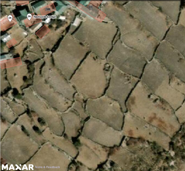
Hello, I'm actually mapping himalayan area. There are many areas like the one attached. Is this landuse farmland or animal keeping?
asked 02 Aug '21, 09:38 Cascafico |
One Answer:
TLDR: use landuse=farmland. AFAIK the animal keeping tag is not meant to be used for pastoral farm use, but for things like horses used for recreational riding. Although many use farmland to solely mean arable farmland, there is not a prescription. Therefore I would tag this with In practice I would expect this is farmland used for growing crops. There are a couple of rarely used tags for different agricultural practices in Nepal, partially related to whether land is irrigated or not. Upland villages tend to have a couple of different crops on the land each year. There are some quite good useful reference photos for villages no the Annapurna Circuit to get a better impression of what they look like. You could also directly contact Kathmandu Living Labs for their advice: it will be much better than mine. answered 02 Aug '21, 12:46 SK53 ♦ |
Thanks for suggesting me to contact KLL. I mailed them :-) In the meantime an italian OSM user linked me a hidef image where you can see hoof prints [1]. at a first inspection, Sentinel vegetation index look similar both in Jan and Jun, altough at such altitude vegetation response maybe is not tuned as for intensive agriculture.
[1] https://upload.wikimedia.org/wikipedia/commons/d/da/Pangbocheview.jpg
I don't think that image excludes: a) freshly tilled arable land; or b) arable land used for aftermath grazing (& therefore dunging) once the crop has been harvested. Using farmland alone avoid trying to make judgements on too little information. Much of the agriculture will not be intensive, but extensive, so I don't know how much change on Sentinel to expect (must say a bit surprised that given it's at nearly 4000 m how little snow cover there is in winter).