Hi has anyone ever used or encountered a blackberry as barrier on a way ? Someone called it modern barbed wire and the cheapest. How to tag it ? asked 08 Jul '21, 16:14 Hendrikklaas |
4 Answers:
Technically thickets of brambles are a classic early stage of scrub formation. They may 'eat' sheep but they provide substantial protection for small saplings from sheep & other herbivores, thus helping scrub with bushes & small trees to develop. This issue is extremely common on paths in Britain. I know at least one OSMer who carries secateurs to cut through such obstructions. Many brambles across paths will just be a hazard at this time of year (just as with big clumps of nettles) and may well be cut-back between now & next spring. If possible I would revisit the path in about 6 months time before deciding if this is a temporary or permanent barrier. answered 08 Jul '21, 22:33 SK53 ♦ 1 I think the traditional tool for clearing a path through bush is a machete, but the only time I've seen them in the UK is in news stories the mention phrases like "armed response unit". (09 Jul '21, 02:08) InsertUser Several of us in my local walking group carry secateurs. https://www.huntsramblers.org.uk/ A few snips will keep a path open. Once a fast growing shoot crosses the path it deters less hardy walkers, and without enough traffic it will become impassable and you'll need a work party to get the path open again. "a snip in time saves nine" :-) (09 Jul '21, 07:00) andy mackey |
Easy enough: barrier=hedge answered 11 Jul '21, 06:17 yvecai |
Hi all, thanks for thoughts over it. There are no rights of way in Holland. I made an extra tour just to ask around or what is going on, halve a day, since another bridge on the same route has been lifted. One of the isles changed in use and owner. It is private since a few years, that explains the temporarily fence behind the blackberry bush. There are 3 bridges involved and out of order. But no signs "private" at the paths, just large reedbeds to hide the damage. I once offered to bring a engine cutter to battle with blackberry to reach a overgrown garage and way but they found Fallopia japonica as well, a mechanical clean up is not the right way then. PS Yvecai, blackberry is not a hedge its an unwanted weed, sometimes. answered 12 Jul '21, 23:17 Hendrikklaas edited 11 Aug '21, 22:24 |
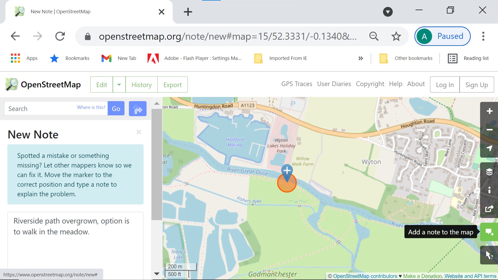
I would just add a map note. see JPEG. Adding a barrier will stop the routers working and because of the lag between OSM data changes and map builds/downloads ( such as OSM on Garmin) and router downloads the barrier could stop the cleared path from being used for long after it has been cleared.
answered 12 Jul '21, 10:40 andy mackey The map note will warn users of the path to come prepared and maybe highlight the problem to those that take care of path maintainance. (12 Jul '21, 10:43) andy mackey 1 co-incidentally I had exactly this problem at New Year 2019, and I mapped the area as scrub https://www.openstreetmap.org/#map=19/52.93068/-1.63446. The council rights-of-way officer subsequently informed me that she had cut through the obstruction. I had meant to check last year but didnt have time at our New Year footpath mapping meeting (12 Jul '21, 13:59) SK53 ♦ |
I encounter them in my back garden all the time. And I call them the worst that climate change has brought to may plants. They have become a pest in the last years.
SCNR and sorry, I cannot be of help with your tagging question.
I have encountered them. I would not map them as a barrier, just snip or chop back off the path. Someone I know suggested that they could almost be considered a carnivorous plant, sheep have been known to become so entangled they died and their remains then nourished the plant, so don't ware a sheep skin coat :-). They make excellent jam though, blackberries that is.
I Googled it:- https://farmingbase.com/are-brambles-blackberry-bushes-carnivorous/