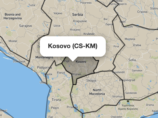
On the map, hovering over Kosovo brings up a pop up description 'Kosovo (CS-KM'). We have had a customer who asked if this can be changed to 'Kosovo (RKS)', to reflect the name that the UK Government officially recognises for this country? How do I do about doing this? asked 14 Apr '21, 16:13 Conor_Kainos |
One Answer:
This does not seem to be OSM data. The Kosovo object has been populated, somewhat inaccurately, with 2- and 3-letter ISO country codes (XK & XKR) since March 2017. I cannot find any time when any tag on that relation shows CS-KM. Furthermore there are NO objects in the OSM database with that value. CS ISO codes ceased to be used back in 2006 according to wikipedia. You need to explain which website, application etc that you are using. It may be a created by a firm who merge OSM data with other sources, in which case it is likely you need to direct your query to them. answered 14 Apr '21, 17:05 SK53 ♦ |


I don't believe Kosovo (CS-KM) is taken from OSM data. So I can only assume your question is about some specific map application or data set. Without you providing more information no one will be able to help you or point you in the right direction where to ask.
What map is that? What is the URL?