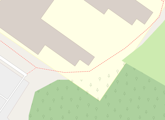
This happens on many renderings, including the default openstreetmap.org map and OSMAnd. On those maps, a part of forest I mapped (natural=wood) that intersects with a university campus (amenity=university) is displayed below the university campus instead of above it. I have seen many places with woods on campuses that were displayed fine, it's just this one, and I don't understand why. Should I map it differently? The area is question is here.
asked 01 Apr '21, 11:36 Giom |
One Answer:
No - if you've mapped what really exists it's up to the renderers to show it properly. Note that some woodland areas in universities display as expected. What might be happening here (in OSM Carto at least) is the "display smaller things on top of larger things" logic not working in you edge case. Note the use of "way_pixels" here. For OSM Carto, perhaps see if someone has already asked about it at the issues list, and if not ask yourself? For Osmand there is currently a Google Group in which those sorts of questions can be asked of other users. This answer is marked "community wiki". answered 01 Apr '21, 12:22 SomeoneElse ♦ edited 01 Apr '21, 12:22 |


There is certainly an issue about this, I'll see if I can find it.