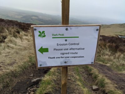
I came across a footpath that wasn't closed, but the land owners are asking you not to use it due to Erosion Control. I've tagged this as
I've no idea if this is the best way to do this though and as it is not a standard tag routers won't pick it up. Is there a better tag for this? asked 21 Mar '21, 10:20 aembleton |
One Answer:
There is limited use of the tag foot=discouraged, which I think covers this type of usage. There are a small number mapped with this tag on the National Trust's Longshaw Estate, such as this one. Aside from erosion control we know the NT have paths through very sensitive habitat where they encourage use of alternatives. However, the access tags such as foot really should contain information on the legal rights, and conflict may exist between a permissive path which is discouraged. For erosion control & biodiversity protection the status of the path is unlikely to change over a few years so it is definitely worth capturing, as is the reason behind it (not all landowners will have as good reasons as the NT). tldr: although foot=discouraged has some deficiencies it is probably the best tag to hand. answered 21 Mar '21, 21:27 SK53 ♦ |