Hi, AFAIK we cannot map fence using the same way of a highway, this will cause routing problem. So this is why I would like to ask how you will map that kind of fence? This is to preserve a natural space and avoid trampling. asked 02 Jan '21, 18:20 Fabe56 |

2 Answers:
I have mapped this type of thing using three ways: One for the fence on the left, one for the trail/track/footway, and another for the fence on the right. It does not render well and getting things all lined up with GPX data and aerial imagery can be a pain. But it is all the better I know how to do. I suppose one could get a discussion going on the tagging email list about using a modifier tag on the traveled way, somewhat like the answered 02 Jan '21, 20:07 n76 |
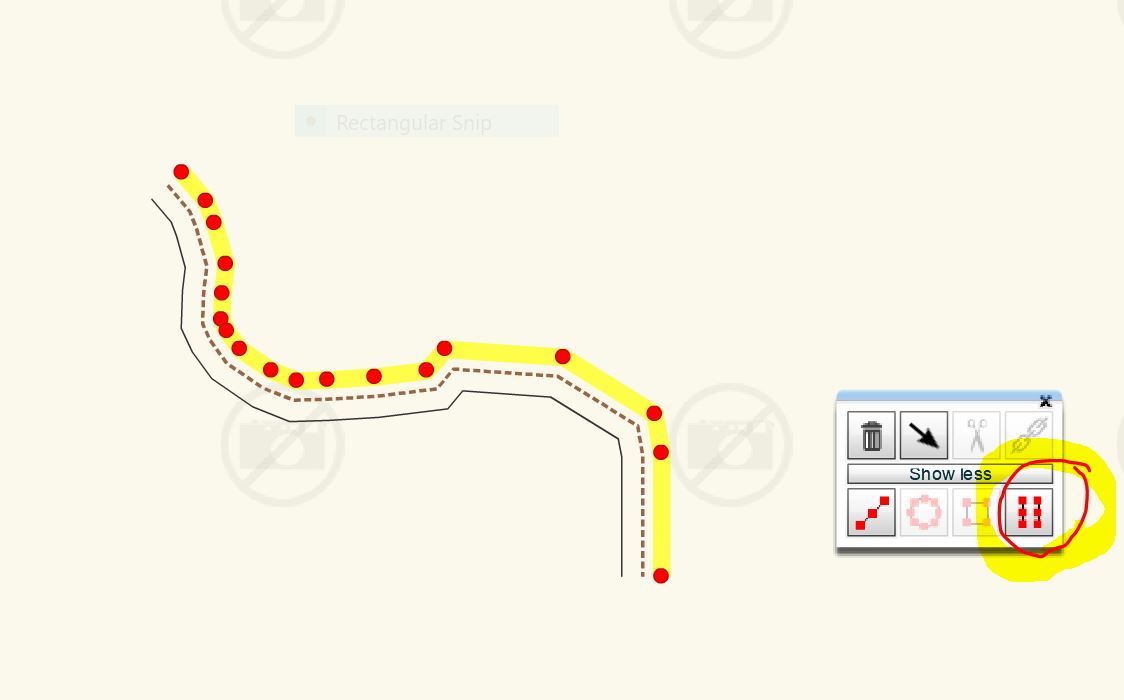
I have been using potlatch2 for several years, which has a parallel line tool which makes this easy. There is now potlatch 3 download to install this editor which also has this same tool. I'm sure JOSM has a similar tool also. https://wiki.openstreetmap.org/wiki/Comparison_of_editors Picture shows the Potlatch3 toolbox and the parallel tool.
answered 02 Jan '21, 21:51 andy mackey edited 02 Jan '21, 22:09 |
Note Versions of Potlatch before the new Potlatch3 needed Flash installed to run, Flash will not be supported from now on so has security issues.
You can download it here https://www.openstreetmap.org/user/Richard/diary/395259