Hello; A few months ago, I edited some trails within the Shugakuin Imperial Detached Palace in Kyoto, Japan, to show that they are only accessible by permission — I set them to the "permit" setting. The location is: 35°03'12.2"N 135°48'05.3"E Even after some months, I do not see those editing changes appearing on the public map. Did I do something wrong? How long does it typically take for changes to appear? This question is marked "community wiki". asked 24 Dec '20, 05:16 mpk-osm |
2 Answers:
answered 24 Dec '20, 07:41 Kovoschiz edited 24 Dec '20, 07:53 In order to enter the Imperial Palace grounds, one needs permission (thus one needs a "permit"). The most important thing, however, is that on map systems like AllTrails.com (which use OSM as a base) the paths should not appear as publicly accessible. (24 Dec '20, 11:06) mpk-osm 1 I've answered the AllTrails question below your "answer" below. With regard to "permit", could you describe the process that you need to go through to access those areas? That would help people understand whether the best access tag really was "permit" or perhaps just "private"? (24 Dec '20, 11:11) SomeoneElse ♦ |
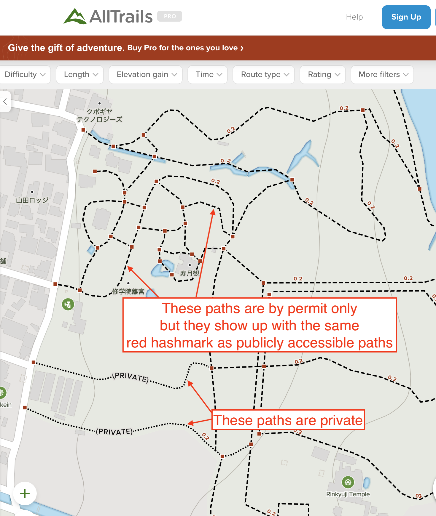
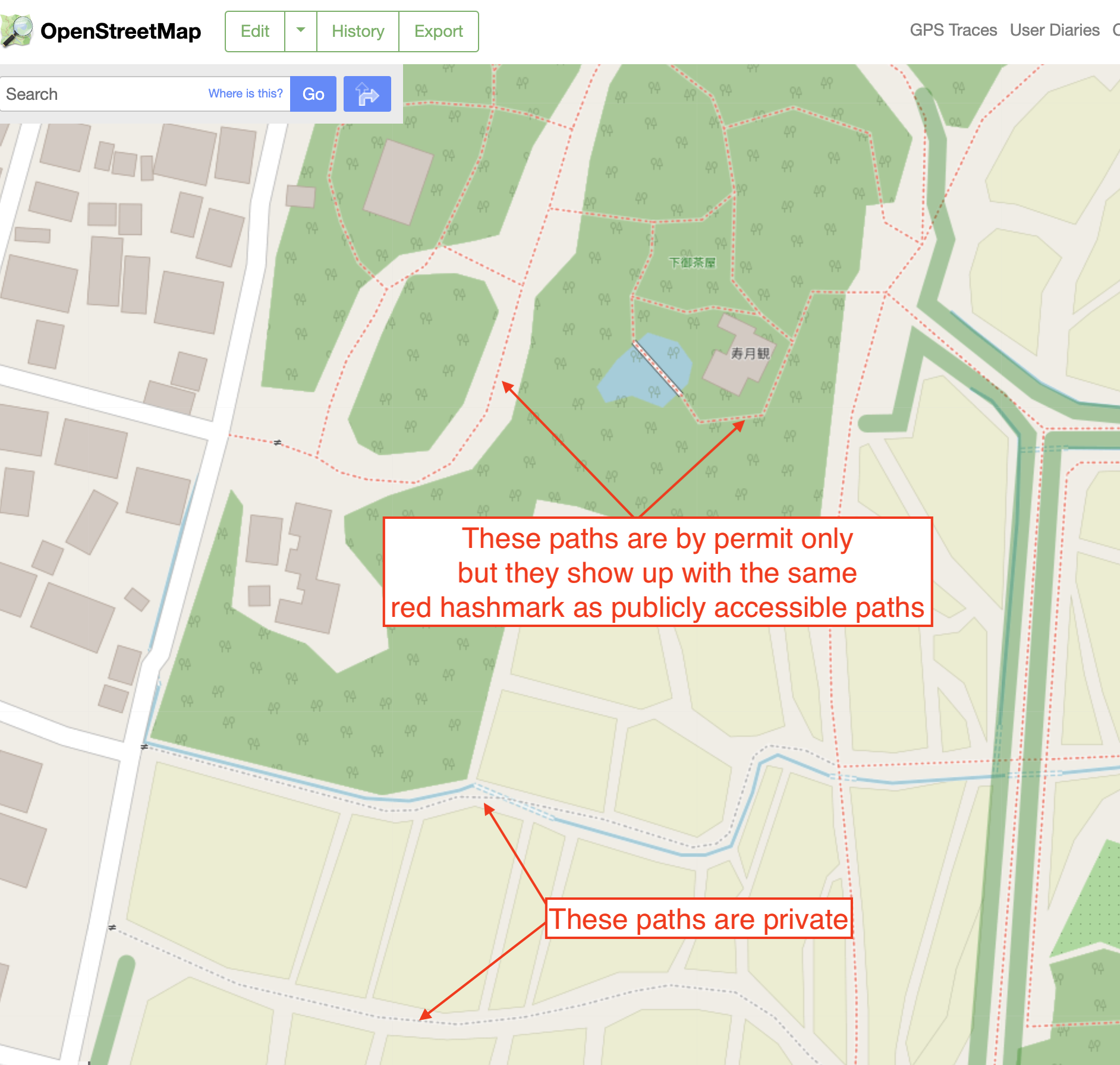
On the public view of the map, as shown in the attached image, the paths in the rice fields to the south of imperial palace are marked in grey hash-marks. These show up as "Private" on the AllTrails map (also attached). The paths within the Imperial Palace grounds, however, which I edited to be "Permit" show up as red hashmarks, like any publicly accessible path, so on maps like AllTrails it seems like they are accessible when they are not. How does one edit the OSM map so the paths will show up as grey hashmarks? Thank you, Marc
This answer is marked "community wiki". answered 24 Dec '20, 11:03 mpk-osm 1 With regard to the Alltrails map, you'll have to ask AllTrails about that. AllTrails uses OSM data, but only they control how OSM data appears on their map, and how long it takes for data that is updated in OSM to appear on their map. We (OSM's Data Working Group) have commented to AllTrails in the past that their representation of OSM data that is private, and data that is not known to be public, is not great and really would benefit from an improvement. (24 Dec '20, 11:09) SomeoneElse ♦ |


Here is a link to a path you have tagged https://www.openstreetmap.org/way/552538714 What are you expecting different to how it is displayed on the osm.