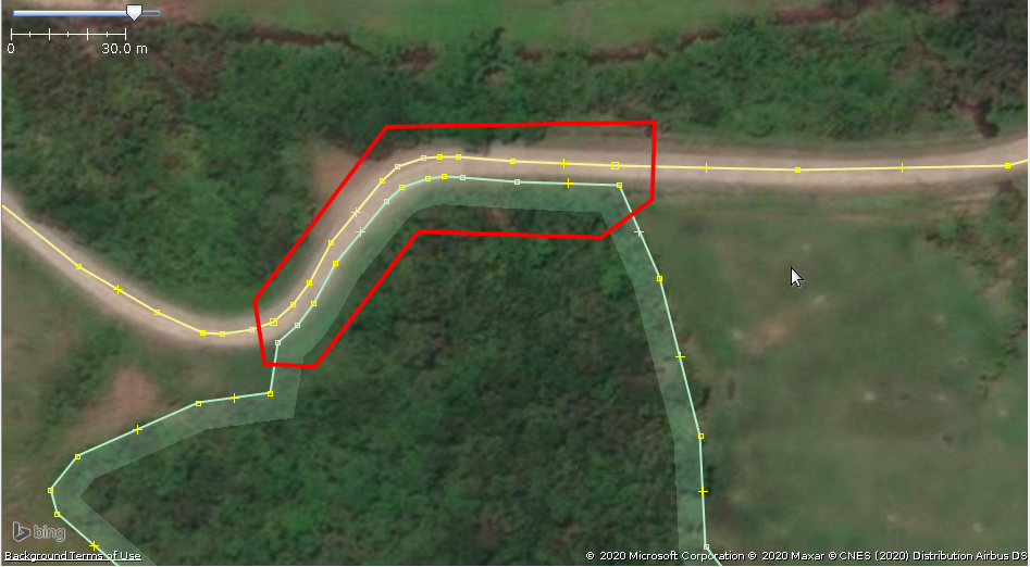
I am having trouble finding a way on how to move several nodes of a way onto another way or polygon. I am able to achieve this in JOSM using Tools > Move Node onto Way, but the tool seems to work only for single nodes. In the image below, I want to move the nodes of the forest (within the red outline) onto the road so that the forest nodes are exactly aligned with or are on top of the road nodes:
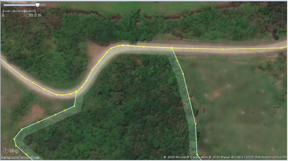
The following is what I want to achieve:
asked 19 Dec '20, 08:06 JAT86 showing 5 of 6 show 1 more comments |
2 Answers:
There are several methods to do this but I'm not going to discuss them because it's not a good mapping technique. The road is not part of the forest and should not be included in it. In addition, it will make future edits of the highway more complicated. It is tricky enough to work with properly mapped multipolygons that legitimately share a way with a highway or boundary line. This sharing is not legitimate. Repeating myself: The forest is mapped correctly in the first image. Please don't proceed with your idea. And, if I can be so bold to ask, please undo any other wooded areas that you have mapped this way in the past. Best, Dave answered 19 Dec '20, 08:42 AlaskaDave |
Hi, What you're trying to do is actually incorrect mapping. The ground truth (from the image) looks like the forest does not extend to the center line of the highway. It looks like the forest line there is parallel to the highway. A IMHO rather complicated way achieve this paralleling is explained here :- https://wiki.openstreetmap.org/wiki/JOSM/Plugins/AlignWayS An easy way is to copy a section of the highway and paste it to the side, then use that as part of the forest way (amending the tags) or use it as a template of part of the forest way to later remove. answered 19 Dec '20, 08:42 BCNorwich edited 19 Dec '20, 08:44 |
In the case of areas to landuse/natural areas to roads: please do not do this.
It is both less accurate mapping and a pain for subsequent editors.
Thank you to all for the enlightenment. Can you please suggest on how to select those (forest) nodes in bulk (I tried Shift+Click to select multiple nodes at once but in JOSM this acts like CTRL+Shift instead as it selects only single nodes) and move these nodes out of the road in bulk?
I would use the lasso select in JOSM to select a group of nodes that need shifting, then shift+select the forest way they belong to, then Tools>Unglue Ways, then hover over one of the selected nodes, left click+drag that group of selected nodes to a more correct position.
I find it works best to select groups of nodes that are aligned horizontally or vertically or diagonally and do each axis separately.
It takes time and is a frustrating task to correct the mess if large.
-using Mac
Thank you very much for the very helpful information.
Potlatch 2 as a parallel line tool in the tool box, bottom right symbol looks like a domino six.