NOTICE: help.openstreetmap.org is no longer in use from 1st March 2024. Please use the OpenStreetMap Community Forum

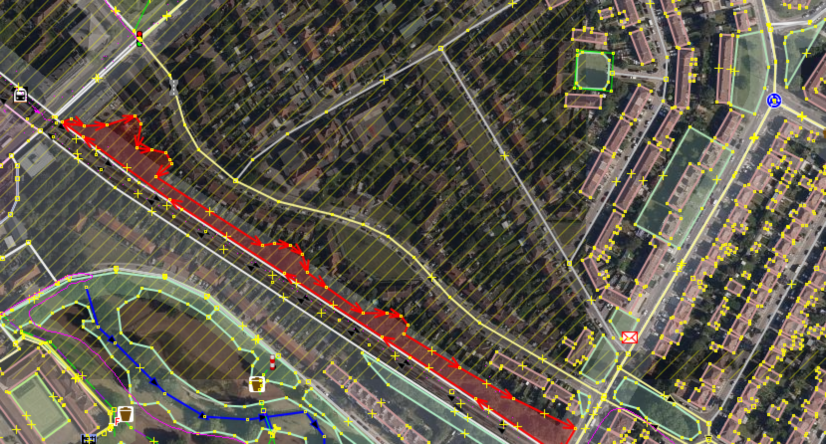
Example area: London, Stretch of a Northern tube line between Edgware and Colindale (https://www.openstreetmap.org/#map=16/51.6014/-0.2575) See screenshot

There are tracks and a fenced area with trees/bushes on both sides. As I understand that's a buffer zone which is maintained (or at least owned) by Tube/Rail company. I see it's mapped as landuse=forest, but from what I've learnt it's not the right usage of this tag. primarily, because nothing is harvested from this 'forest' and it's not really a forest.

So what would you suggest as a better option?

asked 03 Oct '20, 19:16

laechoppe's gravatar image

laechoppe
14113
accept rate: 0%


Most people would tag it as natural=wood as an alternative to landuse=forest. Another lesser used tagging would be landcover=trees but I don’t think many data consumers (i.e. map rendering sites) will render the landcover tag.

Rather than remove the landuse tag, you might want to change its value: landuse=railway. It doesn’t quite fit with the description on the wiki page but if it is owned and maintained by a rail company as part of their infrastructure it seems like that would be okay.

permanent link

answered 03 Oct '20, 21:58

n76's gravatar image

n76
10.8k1082172
accept rate: 17%

1

Exactly what can be inferred from "landuse=forest" and "natural=wood" has been debated for some time - see https://wiki.openstreetmap.org/wiki/Forest for a discussion of that.

"landuse=railway" (in addition to something that says "there are trees here") sounds good for what you are describing though.

(03 Oct '20, 22:06) SomeoneElse ♦
1

Could add an explicit managed=yes if one knows the natural=wood is actively maintained. Sometimes there are vegetation growing mindlessly on managed lands.

(04 Oct '20, 09:33) Kovoschiz

Adding to the answer above, according to this page in Russia they voted for the same approach (use of natural=wood)

permanent link

answered 04 Oct '20, 20:14

laechoppe's gravatar image

laechoppe
14113
accept rate: 0%

Follow this question

By Email:

Once you sign in you will be able to subscribe for any updates here

By RSS:

Answers

Answers and Comments

Markdown Basics

  • *italic* or _italic_
  • **bold** or __bold__
  • link:[text](http://url.com/ "title")
  • image?![alt text](/path/img.jpg "title")
  • numbered list: 1. Foo 2. Bar
  • to add a line break simply add two spaces to where you would like the new line to be.
  • basic HTML tags are also supported

Question tags:

×103
×68
×44
×35
×4

question asked: 03 Oct '20, 19:16

question was seen: 1,318 times

last updated: 04 Oct '20, 20:14

NOTICE: help.openstreetmap.org is no longer in use from 1st March 2024. Please use the OpenStreetMap Community Forum