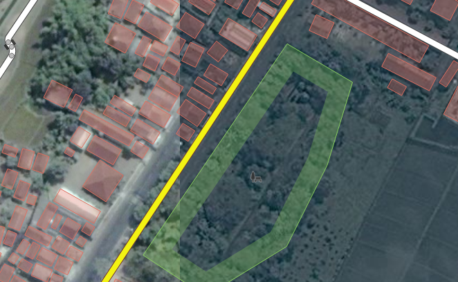
Hi, I'm not sure if this right forum. I think there's a misalignment in satellite map in -8.08139/112.32438.
As you can see, there's different image position in zoom level 18 and level 17 and level 19. It's almost two years and I thought somebody will be notice, but it's not. It's make really hard to align the road and building marker if the reference image itself is not line up. Thank you. asked 06 Aug '20, 13:39 BayuAH |
One Answer:
This seems to be specific to Bing imagery. Is there a reason you want to use Bing in preference to the various other sets of imagery available, which do not appear to have this issue? (See the Background Settings menu item on the right hand side if you are using the ID editor). answered 06 Aug '20, 15:56 alan_gr Discontinuities in imagery mosaics due to different sources / dates / equipment / orthonormalization etc, are completely normal and it is just bad luck when this happens in the middle of a city. Solutions can be:
(06 Aug '20, 18:49) SimonPoole ♦ |


@alan_gr, you are awesome! I do not know that I can change the overlay satellite view. Thank you. So, I should report to Bing, right?
By the way, may buildings marker are also align to Bing Maps. Is there any way to automatically align to another overlay? They're a lot if I do it manually.
There's no automated way. In any case you need to determine if there is any kind of significant offset in the imagery you are using now, and if there is, correct for it first before moving anything (because you don't want to do it twice).
See https://learnosm.org/en/josm/correcting-imagery-offset/ (its for JOSM but the basic principles apply to iD too).
@alan_gr, thank you. I'll check it out.