there are two paths coming, I don't know the date, they are not built yet. so I won't add them. but if I were to add them as proposed or planned or something, I see roads some places are tagged as proposed. but this is a walk and bike path. asked 15 Jul '20, 07:52 mtbboy1993 |
2 Answers:
According to lifecycle prefix planned and proposed paths should be tagged as If the path is already in construction then use answered 16 Jul '20, 07:23 scai ♦ |
Here's one i have mapped
I could have also added a proposed tag, but it is an actual path now and the local authority have confirmed it. It isn't open yet. One problem is surveying something when you should not be there, or copying it from a copyrighted plan, which isn't allowed of course. Letting people know what is planned is, i think a good idea. Edit I guess new path could be at different stages, proposed, planned, under construction with a barrier fence before finally being opened as a designated path for for example foot and or/or cycles or horses. answered 15 Jul '20, 13:54 andy mackey edited 15 Jul '20, 14:38 showing 5 of 8 show 3 more comments |
the path has been planned for years, and now it's confirmed it will come, but no date set. but I have seen the plan drawings. there is no path built yet. but the money is there, it will cost 50 million Nok https://www.smaalenene.no/lokale-nyheter/punger-ut-50-millioner-til-gangvei-her/s/1-87-7189782 https://viken.no/tjenester/vei-og-kollektiv/fylkesvei/veiprosjekter/veiprosjektartikler/fv-128-slitu-sekkelsten.22187.aspx
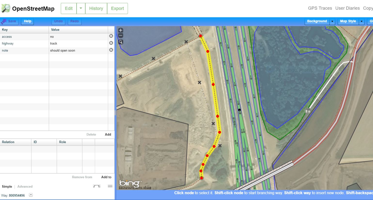
there is a path that is under construction at a different location, that one has the drainage carpet and gravel already laid, no asphalt yet, and is a dead end. how should I tag it? it's planned to connect to a bridge that already is, the path will go around an apartment building that is planned. sign and swing gate is set up. I tagged it as a closed road, is that correct? https://www.openstreetmap.org/way/720561813
where did you get that system from?, I don't have this.
The second path example looks OK to me. In the last comment what system are you speaking of?
If a path is mapped from a plan, and that plan is based on a copyrighted source we should NOT copy from it. If path position can be estimated from a remote survey and/or bing or other OSM supplied source then it should not be a problem.
I meant the window thing wit the blue stuff and all. what key do you press to get that? is that desktop software or is this in OSM website? sure looks to be the website.
mtbboy1993 The jpeg i attached was a window snip of the Potlatch2 editor with a new path selected and ready to edit. The side panel shows the tags i used at the time.
I walked this path a couple of months ago and according to the local press work had finished on it ( A14 road project ) BUT the contractors are still working and it's now locked off at the underpass of the A14 which is to the north of my pic. ( i checked on the 17072020