Hello, I am a new contributor and recently submitted two contributions. I'd like to learn from the process and would appreciate feedback on how to better handle future submissions.
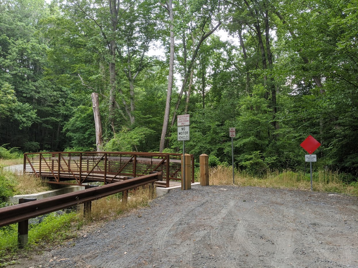
For the first contribution (which ended up being 2-3 submissions), if I switch to the OpenCycleMap, the new road & bridge do not exist. When I created the first contribution, I tried adding by hand. I biked this course beforehand to get perspective. Is there a mechanism to use GPX coordinates for adding a road? Here is the Strava activity (which can be converted to a GPX): https://www.strava.com/activities/3661475773 And a picture of the pedestrian bridge.
For the second contribution, I set the tag bicycling as true. I use these Maps for my Hammerhead Karoo, but it seems they still do not see that path as cycling capable. I've emailed them to see if maybe I did something wrong. asked 09 Jul '20, 01:21 kjellberg showing 5 of 6 show 1 more comments |
One Answer:
Hi, For the first question, the OpenCycleMap query has been addressed before here :-https://help.openstreetmap.org/questions/3950/when-does-a-change-get-updated-on-the-opencyclemap It might take a few days for all tiles to be re-rendered. As for the bridge, as mapped it will not be routable as it is not joined to the eastern section of Wilkinson Road and the service road. The second question, it may well be an anomaly with Hammerhead Karoo. The way is however joined onto the river multipolygon which may or may not cause a problem. Just my thoughts/observations. answered 09 Jul '20, 08:02 BCNorwich 2 To expand a bit on what course of action you need to take now kjellberg: The node on the Eastern end of the bridge needs to be joined to the connection point of the residential and service roads. Now they overlap but are not truly joined. In iD click on the node, drag it a bit to any side and move it back into its old position pressing Cntrl at the same time. Watch how the dot changes from one with a double line to one with a single line. You added the bicycle=yes to the path leading to the Lower Susquehanna Heritage Greenways Trail but on its Northeastern end that path is connected to another path with highway=footway which will also be ignored by many bicycle routers. Make sure all paths in the vicinity carry the correct access tags. A highway=path should be routable by bicylce by default, a highway=footway should not (although you will find many routers that don't handle it that strictly). I don't believe the path being connected to the river (about midway) is a problem but it surely does not hurt to separate both. (09 Jul '20, 12:15) TZorn 1 Thanks for the explanations! This was very helpful. Reading that issue, even though its been 15 days, it seems the OpenCycleMap can take weeks to sync the latest changes, so I'll be patient. For the Hammerhead Karoo, both paths (highway & footpath) on each side are deemed usable by bikes, so I'm waiting for a response from Hammerhead on why the path is not recognize with the new tag. For Wilkinson Road, I moved the line and moved it back. This time it properly attached as if I tried to move it again, it would pull the road. Thanks for discovering that. I did not have to use CTRL and did not see a UI behavior change oddly. Any thoughts regarding how to use a GPX file to improve the accuracy of a road compared to hand dragging lines over poor visibility satellite forest? (09 Jul '20, 14:50) kjellberg 3 Hi, Upload the GPX files to OSM (Please see here for instructions :-https://wiki.openstreetmap.org/wiki/Upload ). GPX traces can then be shown in the iD editor by selecting the box in the Background settings box (shortcut B). You might not get very accurate traces under tree cover, best to make several traces of the same route. (09 Jul '20, 15:35) BCNorwich |
If you want faster feedback, join OpenStreetMap’s slack: https://osmus.slack.com/
*OpenStreetMap US's Slack
To get into the Slack, it states: "Don’t have an @openstreetmap.us email address? Contact the workspace administrator at OpenStreetMap for an invitation." but does not offer a contact for the admin.
See https://www.openstreetmap.us/community/ on how to get in touch with the community and join Slack.
From https://osmus.slack.com/ I've just clicked on "get an invite" and got an invite immediately. "Having an @openstreetmap.us address" was never mentioned.
The URL linked does not provide a 'Get an invite' for me. I had to use the URL https://slack.openstreetmap.us/ and have successfully joined the Slack. Thank you!