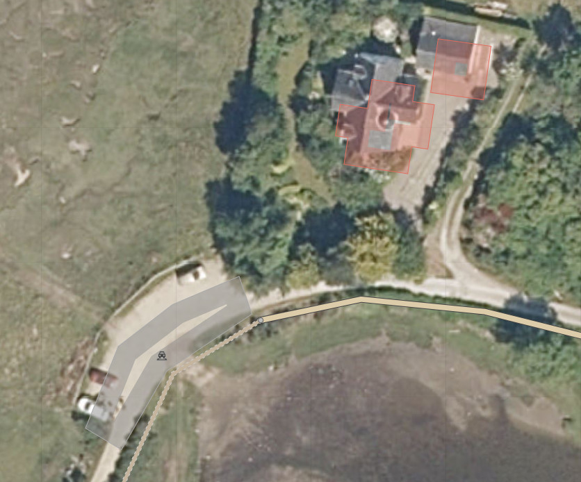
In the last couple of days I've noticed in the open street map editor that the map and the satellite imagery are now not aligned correctly. It looks like most objects (not just ones I've added and updated) are now a little south east of their positions on the satellite imagery, was there a recent update where the alignment was adjusted? Thanks, Mark
asked 07 Jul '20, 23:12 mcjhn |
2 Answers:
OpenStreetMap has a number of satellite imagery layers, each from different commercial providers and each of those providers makes their own updates and realignments from time to time. None of them provide OpenStreetMap with notifications of which areas are updated or realigned. The important thing is to use the GPX traces for the area, to find out where features like roads and paths truly are. This allows you to decide if the imagery or the OSM data (or both) are in the wrong place, and therefore what needs re-aligning. It's best to never assume that the imagery is right, but the GPX traces are generally much more reliable, particularly if there's a few different traces for the same feature. answered 08 Jul '20, 08:57 Andy Allan OK many thanks. (08 Jul '20, 12:49) mcjhn 2 The Ordnance Survey StreetView layer is quite useful for checking whether buildings & roads in OSM are likely to be well aligned or not. The tiles are created using quite a precise transformation from the British Grid (the 2002 one IIRC rather than the more recent 2015 specification) and thus should be accurate. I find it helpful to check the general alignment of roads and buildings before using a particular imagery layer. It has an advantage over GPS tracks in being available everywhere. The map is generalised so buildings are simplified and merged so it's not a particular good source of actual building profiles. It dates from 2016 so the actual road layouts may have changed, but usually there are enough hints to allow checking of alignment. (09 Jul '20, 16:26) SK53 ♦ |
The best thing to do is of course align to GPS trace (but there might not be many of them) or Strava's heatmap. However the next best thing is to just align the new Bing imagery with the Esri World Imagery (clarity), which should be the old Bing imagery and line up with the current buildings. The worst thing would be to start tracing the new Bing imagery without changing the offset, which leaves you with two sets of misaligned objects and makes it harder to just move them all at a later date. answered 11 Jul '20, 19:23 GinaroZ |


https://help.openstreetmap.org/questions/71775/is-there-a-way-to-align-offset-of-satellite-images-while-editing
OK many thanks.