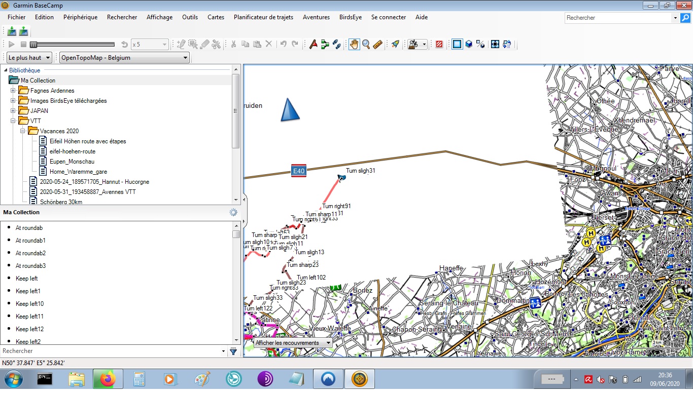
asked 09 Jun '20, 19:26 JPM58 edited 09 Jun '20, 19:38 |
One Answer:
If that area displays before zooming in it probably is NOT a fault of OSM data or the opentopomap download, perhaps Basecamp is the problem, try a reinstall of that. If you have a Garmin GPS does the .img file display and work as expected? answered 10 Jun '20, 11:12 andy mackey 1 Hi Andy, thanks for your advise. I checked this morning on my Garminmap 66 and yes it works! I should have checked this first! I'll make a Basecamp reinstall with new file. Thanks to All for your help (10 Jun '20, 11:26) JPM58 |

 Hi all! I'm using topomap since a while, and love it. But since a few weeks, a large area in Belgium turns blank (completly white) when I zoom above half scale. I downloaded again the last version, but no change. Anything I can do? I'm using garmin base camp on win7 pro. Thanks for your help. JP
I presume you've downloaded an OSM-based Garmin map from somewhere - where was that? There are lots of different sites, and they all create different maps.
quick response! Here's the link I followed: http://garmin.opentopomap.org/