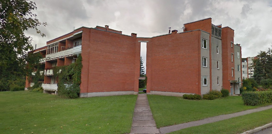
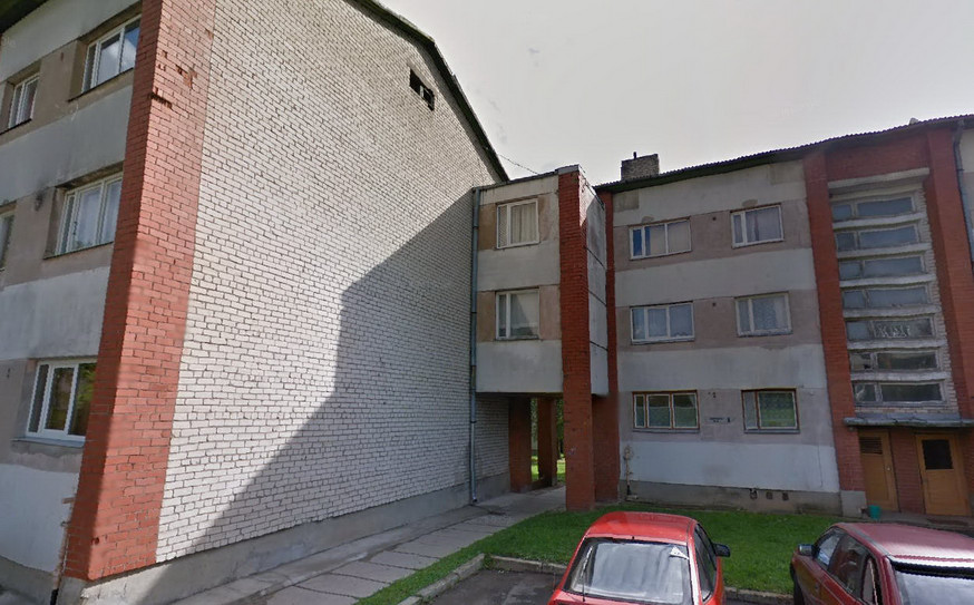
So, I'm currently mapping out my hometown, and we have a lot of these Soviet style apartment buildings where everyone lives in. Some of them are connected together with different "connector" bits. In some cases, it's just a brick arch, in some cases it's like a corridor that goes between them. And there's always a footpath going through on the outside. But in both of those cases, they are each a separate freestanding building, rather then a single building with building passage through it. Sometimes both buildings would have a single address, some times they would have a different streetnumber assigned to each. How would you map? Draw a single building shape? Put a tunnel=building_passage under ? Draw two buildings and connect them with the corner nodes? But then, it's not just a connecting point, it's an area. Draw two buildings and draw the middle bit out separately, and put layer=1 on the middle bit? But what would the middle bit tags be? This is the place, and one of them: https://www.openstreetmap.org/way/111713800 asked 05 May '20, 22:53 ivss_xx edited 05 May '20, 22:54 |
One Answer:
For the second one, I definitely use tunnel=building passage. For the first one, I would ignore the small piece at the top and just map it as a path (or footway) between 2 non-connected buildings, as it does not feel that the path is covered. I guess that when you are mapping 3D buildings (or want to be more precise), you might want to map that small piece as well. answered 06 May '20, 08:12 escada |
Would you map 2 buildings for the second one or one? I didn't think of it at first but I'm thinking now that I'm gonna do two buildings with connected nodes and add the overhang part to one of them.
I tend to split such buildings only when they do have different house numbers. However, that might depend on the local situation.
I'd definitely map them as separate buildings with the connector possibly as a third or as you suggest as part of one of them (either way you are going to need to tag this part separately). For the second I agree, a single building with tunnel=building_passage. I presume the connector contains some kind of infrastructural service such as heating or electricity