NOTICE: help.openstreetmap.org is no longer in use from 1st March 2024. Please use the OpenStreetMap Community Forum

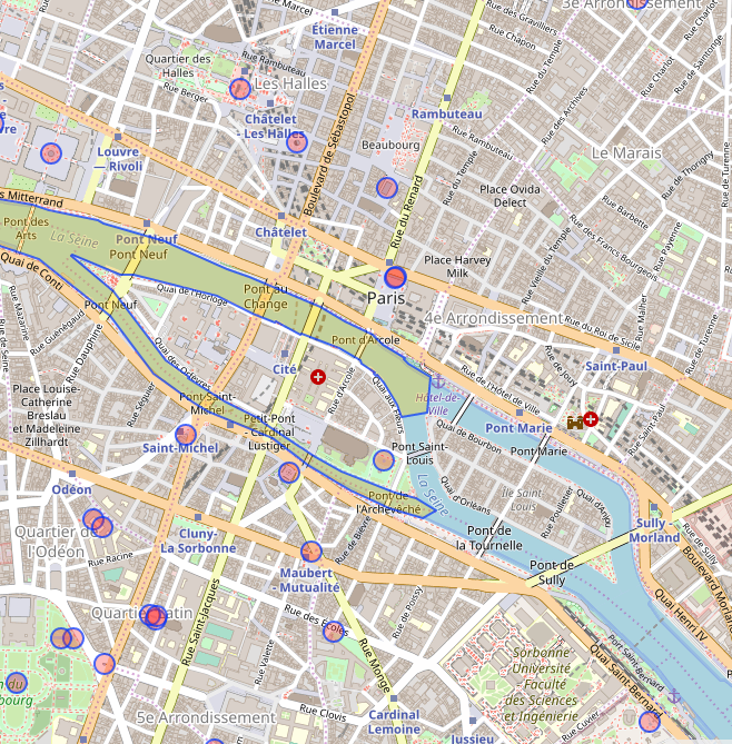
I'm querying water in a 5 km radius of Paris city centre and was expecting the Seine to show up in its entirety; however, it's only showing in part as a polygon?

What am I doing wrong, please?

Query:

[out:json];
nwr["natural"~"water"] (around:5000, 48.8693488, 2.319511); 
out meta;
>; out skel qt;

I do query the using 'river' separately but I really want the polygon and not the line!

alt text

asked 10 Mar '20, 14:18

jusdespommes's gravatar image

jusdespommes
11335
accept rate: 0%


Please have a look at the wiki on different ways to tag rivers. The Seine to the East of your selection is tagged as waterway=riverbank.

permanent link

answered 10 Mar '20, 14:51

TZorn's gravatar image

TZorn
12.3k764225
accept rate: 15%

Thank you!

I have that in my separate river query - however, I only get a polyline back in my output. Is there no way to get a multi-polygon instead, please?

alt text

(10 Mar '20, 15:38) jusdespommes

Replied below to add a pic!

(10 Mar '20, 15:38) jusdespommes

Well you get the objects back that are in the database. If you want to join them or whatever it is you hope to get out of a multi-polygon you have to do some post-processing afterwards.

Maybe you describe a bit better what it is you try to achieve if I missed something.

(10 Mar '20, 19:06) TZorn
Your answer
toggle preview

Follow this question

By Email:

Once you sign in you will be able to subscribe for any updates here

By RSS:

Answers

Answers and Comments

Markdown Basics

  • *italic* or _italic_
  • **bold** or __bold__
  • link:[text](http://url.com/ "title")
  • image?![alt text](/path/img.jpg "title")
  • numbered list: 1. Foo 2. Bar
  • to add a line break simply add two spaces to where you would like the new line to be.
  • basic HTML tags are also supported

Question tags:

×79
×73
×5

question asked: 10 Mar '20, 14:18

question was seen: 1,336 times

last updated: 10 Mar '20, 19:06

NOTICE: help.openstreetmap.org is no longer in use from 1st March 2024. Please use the OpenStreetMap Community Forum