Hi ! There is a form to modify a map created in OSM to avoid the splitting of a route that crosses the International Dateline...? The resulting map looks ugly. Thanks in advance
asked 11 Feb '20, 09:46 StratoCat |
4 Answers:
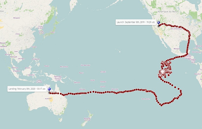
After a number of tries, I finally found it ! You have to subtract 360 to all positive longitudes (the reverse might also work). Here is your updated file I used some vim magic to do it, first conversion from tsv to csv, then calculation : You probably can do it with any spreadsheet software, but I'm glad I've learned to do it with vim. ;-) Side note, gpsbabel is great for converting positions, especially to gpx as track, but was not needed after all. I just exported my already shown try, and looked at the data. When I found a longitude of -247 I guessed this would work. answered 11 Feb '20, 18:04 H_mlet 1 It also works by adding 360 to negative longitudes, and this is the command : (11 Feb '20, 18:07) H_mlet Absolutelly Awesome. You saved my day ... really. A BIG thank you! (11 Feb '20, 19:51) StratoCat You're welcome. :-) It should be documented somewhere... (11 Feb '20, 22:02) H_mlet |
Did you try to manually center your map on the pacific ? I've created a polyline across this ocean, and it looks alright, see below. You might share your map URL, or the original data, for further experimentation. Regards
answered 11 Feb '20, 16:06 H_mlet edited 11 Feb '20, 16:07 Sure... the URL is https://umap.openstreetmap.fr/en/map/project-loon-hbal011_418121 The data are lat,lon locations (11 Feb '20, 16:12) StratoCat Lat Lon 41.090046 -117.24723 41.246807 -116.93441 41.386356 -116.76473 41.585396 -116.60854 41.72139 -116.30826 (11 Feb '20, 16:14) StratoCat |
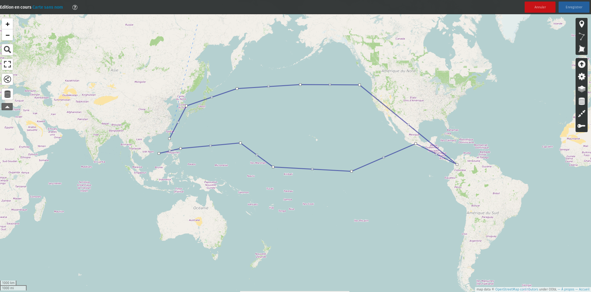
It looks like an old unsolved problem : https://github.com/umap-project/umap/issues/33. It's sad if it works only with a manual polyline. You might try to convert your csv to a GPX "track", and import, to force it to display as a line. Or try to draw a line across the pacific, before the import ? Please send a CSV file if you want me to try these things. Regards. answered 11 Feb '20, 16:29 H_mlet Any help on this will be very welcome. How I can convert it to GPX? The CSV file can be found here https://stratocat.com.ar/hbal011.csv (11 Feb '20, 16:40) StratoCat |
It looks so nice now...
answered 11 Feb '20, 19:57 StratoCat |
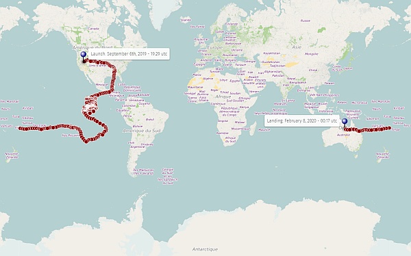
Hi, what tool are you using to create this map ?
I'm importing location coordinates (Lat, Long) in uMap (https://umap.openstreetmap.fr/en/)