NOTICE: help.openstreetmap.org is no longer in use from 1st March 2024. Please use the OpenStreetMap Community Forum

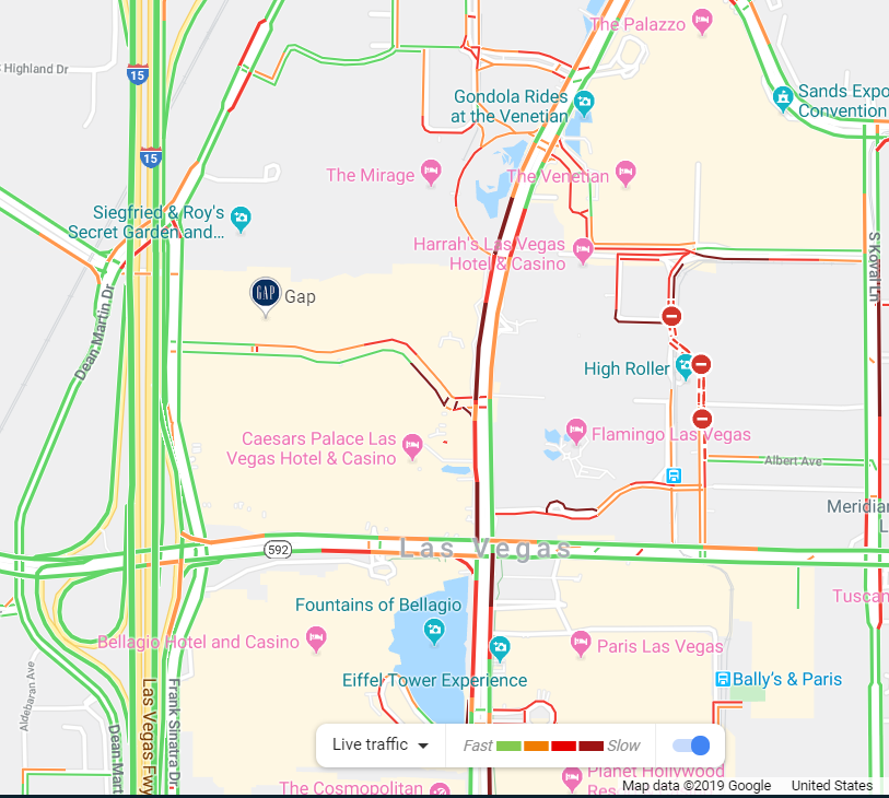
Hello. I'm interested in customizing the streets that can be color coded based on a set of values that I assign. For example, a 1 mile street named 1st street intersects with another 2 mile street called 2nd street. 1st street will be colored BLUE for the first 1/2 mile, and then will change to GREEN for the other half, which is the part of the street that intersects 2nd street. What I'm trying to do is very similar to what google maps does by coloring road/road-sections in relation to the level of traffic on that specific part of the road. I pasted an example of Google Maps traffic congestion data visualization.alt text

asked 31 Dec '19, 05:41

Enshin's gravatar image

Enshin
11113
accept rate: 0%

edited 31 Dec '19, 05:49

Be the first one to answer this question!
toggle preview

Follow this question

By Email:

Once you sign in you will be able to subscribe for any updates here

By RSS:

Answers

Answers and Comments

Markdown Basics

  • *italic* or _italic_
  • **bold** or __bold__
  • link:[text](http://url.com/ "title")
  • image?![alt text](/path/img.jpg "title")
  • numbered list: 1. Foo 2. Bar
  • to add a line break simply add two spaces to where you would like the new line to be.
  • basic HTML tags are also supported

Question tags:

×142
×3

question asked: 31 Dec '19, 05:41

question was seen: 1,125 times

last updated: 31 Dec '19, 05:49

NOTICE: help.openstreetmap.org is no longer in use from 1st March 2024. Please use the OpenStreetMap Community Forum