Hello! I have recorded the exact same track with three different apps. When I transferred them into OSM, the tracks were going zigzag on the walked roads. Why is that happening? How do I solve it? The apps I used were "Track My Trip - GPS Tracking & Online Sharing” (Version: 3.3.0), “Geo Tracker - GPS tracker” (Version: 4.0.2. 1750) och “A-GPS Tracker” (Version: 3.6.5). Thanks in advance! asked 27 Nov '19, 13:36 Nadjajdan |
2 Answers:
My guess is that the issue is with the GPS receiver in the device you used to record them. A lot of older or even current mid-range and lower mobile phones have marginal GPS antennas and chipsets. If you recorded the tracks using a reasonably modern dedicated GPS device or newer high end mobile phone, then there may be some environmental issue in that area that is affecting the GPS reception. Typical are things that block full view of the sky like cliffs or tall buildings. Also wet leaves will affect the signal so a forest with broadleaved trees, especially after a rain, will affect things. And then there is multipath where signals bounce off some metal object, like a large water tank, before getting to your phone. Bottom line is that consumer level GPS devices are not perfect. Which is one reason the recommendation is to get multiple tracks and then average them out. answered 27 Nov '19, 18:25 n76 |
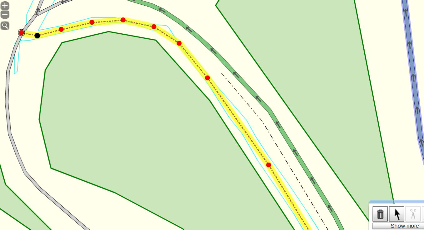
I agree with stf. This illustration shows a trace where i walked up and down a new Bridle Way, these are for foot, cycle and horse traffic only in England. This one is 4 meters wide and i walked north on one edge and south on the other ( I did move a bit to observe some other stuff). The trace was recorded with a Garmin Oregon 450 that i've used about four years i think. I carry it in a pouch at shoulder level on backpack strap, so my bodies obstruction of signal is reduced. I hope this picture is of help.
answered 27 Nov '19, 19:49 andy mackey I also get good results with an old moto G2 phone, but the results would be improved if i held it out in front and didn't stick it into a pocket. (27 Nov '19, 19:53) andy mackey |
did you upload them as "public, unordered points" ? If so, see https://help.openstreetmap.org/questions/66689/what-does-unordered-mean-in-visibility-option-for-gps-traces
Would it be possible to upload a public track? If other people look at https://www.openstreetmap.org/user/Nadjajdan/traces they don't see anything. If you don't want to make your existing tracks public you can record some new ones.