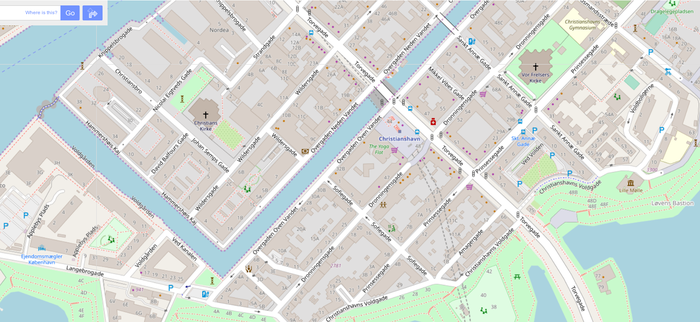
While looking at a map, sometimes an icon or feature looks interesting, but if you click on the icon nothing happens ... Some tenacious users might discover that in order to unlock the data behind the icon, like web address, opening hours, and so on, you have to right click in the area, click "Query features", and then select the correct feature from the list in the left hand side. For an example, see The Royal Library: https://www.openstreetmap.org/#map=19/55.67356/12.58299 It would be great if the user could click on the icon "Det Kongelige Bibliotek" and get the Library information shown, like this: https://www.openstreetmap.org/relation/2682249 asked 06 Nov '19, 17:11 ragit |
2 Answers:
Clickable POIs is one of the Top Ten Tasks. There is also a corresponding GitHub ticket at osm-planning. So far there is a lack of web developers to make it actually happen. There are various third-party OSM-based websites with POI filters such as OpenPoiMap and OpenStreetBrowser. There is also Qwant Maps which is based on OSM and offers clickable POIs. If you have experience with web development then don't hesitate to support these efforts. answered 07 Nov '19, 08:51 scai ♦ Thanks for guiding me to Clickable POIs on the Top Ten Tasks @scai, as well as corresponding issue on Github, it is exactly what I am looking for. My web development skills are fairly limited, but I'll check it out. Perhaps I can replicate and test any solutions in the making? Have a great day! (07 Nov '19, 20:38) ragit |
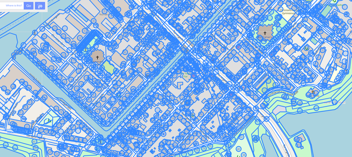
You know there's a map data layer right? This also shows objects not rendered by OSM Carto. answered 07 Nov '19, 05:16 Kovoschiz edited 07 Nov '19, 05:16 Thanks for the info @Kovoschiz, I wasn't aware of the map data layer. It is quite useful for an editor, but probably not for an ordinary user, since all information is shown, which hides the icons, and makes loading and dragging the map slow, due to the huge amount of data it has to download and render in the browser. My idea was something much lighter. See for example this map in default view, with roughly 20 icons of interest, which could be clickable: https://www.openstreetmap.org/#map=17/55.67167/12.58990 The same map, with data layer, which takes 7-8 seconds to render. Also I get the message: "Loading 2006 features, which may make your browser slow or unresponsive. Are sure you want to display this data?" https://www.openstreetmap.org/#map=17/55.67167/12.58990&layers=D I hope you agree it's not an optimal user experience? I think openstreetmap.org is an amazing project. My only goal here is to make the front-end more user friendly and useful for ordinary users, who are used to features such as the one requested in this issue. Map, default view Map, with data layer enabled (07 Nov '19, 08:36) ragit You mentioned "data", "tenacious users"; and used a multipolygon as an example. At that time, it sounded like you were asking from a power user, or editor POV, since at the same time, website itself is more of a WIP/prototype. I thought that you will want to an immediate solution (good, or not) in a help / Q&A forum here. You will have a better chance at making suggestion and discussing improvements in the relevant channels, as @scai described. (08 Nov '19, 08:15) Kovoschiz |
This seems to be essentially the same question as https://help.openstreetmap.org/questions/71483/show-search-results-as-clickable-icons-on-map ?
No, this question is simply about making icons clickable. Currently, they are inactive. Try clicking on "Det Kongelige Bibliotek" in the search above to verify, nothing happens :-)
The other question is asking for "... with the matches shown on the maps as clickable/hoverable icons:" as well though?
Sure, but essentially the other question is about showing search results as icons on map. To help separate the two issues I have removed "clickable" from the title in the other issue.
thanks for query link