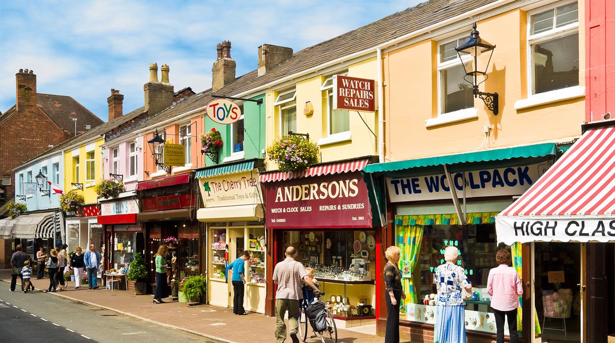
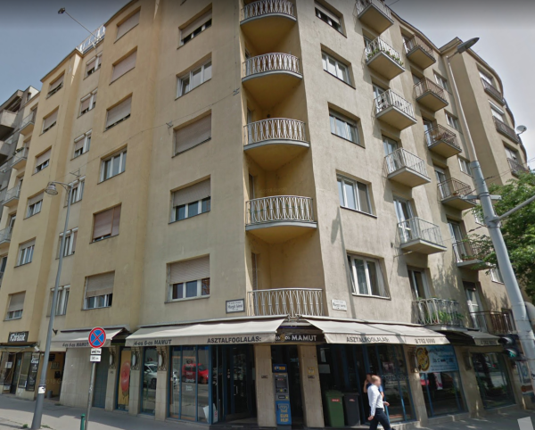
In Europe there are lots of areas (especially in city centers) where the first level of a building is occupied by something commercial (retail, services, catering) and all the higher (1 or more) levels are residential/living spaces. For example:
How should we tag such buildings and the landuse for them? Are they residential or retail/commercial? asked 10 Oct '19, 23:34 UntaggedWay edited 10 Oct '19, 23:34 |
3 Answers:
There is no mixed landuse in OSM and to my knowledge there is no general agreement on how to tag such areas. As often in OSM where concurring characteristics have to be tagged try to use the prevailing one. In my area such areas tend to be tagged as landuse=retail or commercial if they are main centers for people to go shopping, often in the city/suburb center and often being a pedestrian area. They tend to be tagged as landuse=residential if they are just some shops along the road. But I say "they tend to" because there is clearly no general rule. Some general remarks: answered 11 Oct '19, 08:24 TZorn |
I see TZorn's very reasonable answer has already been upvoted and accepted but I'd like to offer a different take. My experience comes mainly from New York City which obviously has very high density of both residence and commerce. There are purely residential neighborhoods and purely retail/commercial/industrial areas, but a lot of the city, especially closer to the centre, is mixed zoning. Early NYC mappers found that trying to classify all of the city's landuse was counterproductive and prone to disagreement, and arrived at the following "standards":
Just to be clear, I don't think this is the only valid solution. But nor is there a law that says every square inch of the Earth's land has to be tagged with a landuse, and therefore we have to just assign the best fit even when it's not 100% true. Leaving off the landuse tags altogether is similar to using Speaking of buildings, you also asked about building types. I'd be perfectly comfortable using answered 11 Oct '19, 15:34 jmapb edited 11 Oct '19, 15:53 |
This type of question has been asked frequently in the past. See for example answers to : Tagging landuse in downtown areas. Your nice pictures I would unequivocally tag as landuse=retail (see my old answer above). answered 11 Oct '19, 17:40 SK53 ♦ edited 14 Oct '19, 09:02 EdLoach ♦ |
See also https://help.openstreetmap.org/questions/23994/tagging-landuse-in-downtown-areas