Hello i 've been wondering for quite some time, why thw building blocks in athens are not available although visible. Its extremely important to anyone downloading for research etc. In he past we had to make them by hand for large areas asked 21 Jul '19, 11:26 papsphilip |
2 Answers:
What you are referring to as a "city block" is I think this landuse=residential area. If that's what you want, extract "landuse=residential" (or commercial) using Overpass. To see what anything is on the openstreetmap.org map, zoom in and click on the "query feature" icon at the right-hand side, then click where you are interested on the map. answered 21 Jul '19, 13:57 SomeoneElse ♦ edited 21 Jul '19, 13:58 |
Other people have been looking for something like this before. Maybe some of that helps: https://peteris.rocks/blog/openstreetmap-city-blocks-as-geojson-polygons/ answered 22 Jul '19, 13:59 TZorn thanks i'll check it out, seems promising but a bit complicated maybe. Another thing i'll try is recreate the city blocks myself inside houdini, using the landuse polygons and the road network. (22 Jul '19, 15:28) papsphilip |
Can you explain in a bit more detail what you mean by "building blocks in athens" and also what you mean by "not available although visible"? It would help to say what you're trying to do and what you're unable to do (what URLs you are accessing, what software you're using, that sort of thing).
I want to download the overpass api and import it into houdini for processing. I need to have access to all the attributes, the lines and polygons themselves. I ve done this already everythings works fine the only problem is that there are no polylines or polygons defining the city blocks. Perhaps thats were you lost me, i need the city blocks (not building blocks). So if you navigate to Athens you will see the city blocks in red color below the buildings, they are visible. But when exporting this using the overpass api they are not there, also if you do a query on the city block it is as if its not a shape-polygon-polyline.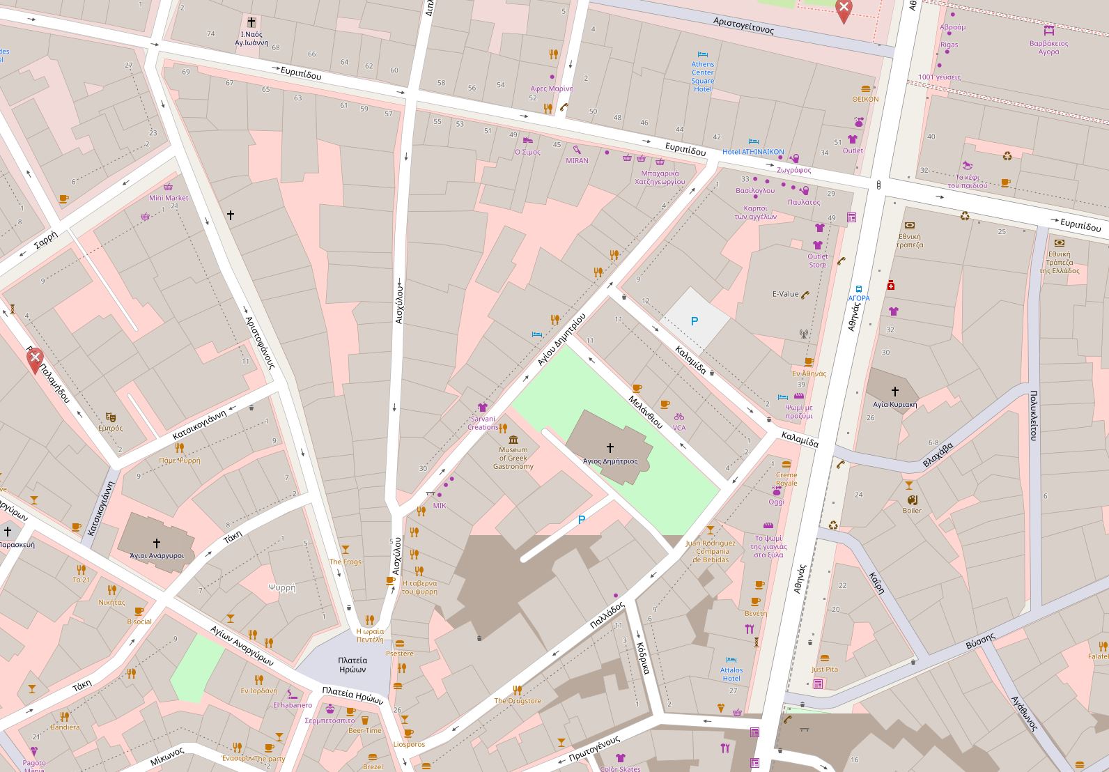
So i checked the landuse attribute, and it doesnt represent the city blocks. you can see in the attached images that the landuse from open street maps is something much more general. what i want is in the second image, and you can see the problem. The query feature doesnt provide information on the red polygons below the buildings that actually represent the city blocks! can you confirm that you see the city blocks and the query does not provide information on those? it definetely not landuse=residential, landuse defines larger areas. image number one is what i would like to export image number two is what landuse - residential provides and i ve drawn on top the three city blocks from the first image.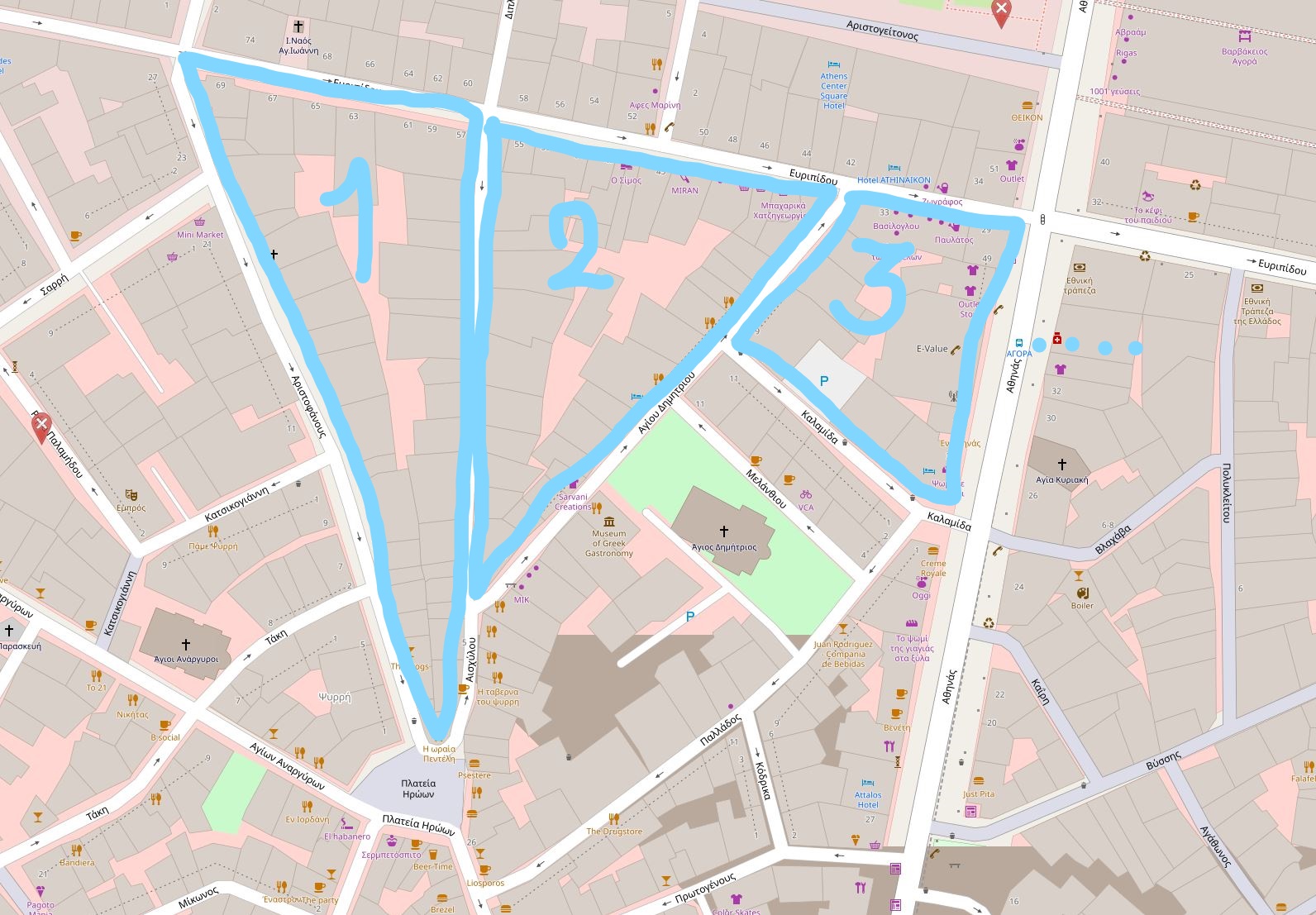
What you're seeing on the standard layer at openstreetmap.org is lots of things drawn on top of each other. There are roads drawn on top of https://www.openstreetmap.org/way/86440081 , which is why it looks like that landuse=residential area is several separate areas. If you zoom in and out (so that drawn road widths change) you'll see that the landuse=residential always goes all the way to the drawn edge of the road.
ok, so this information doesnt exist yet! thanks now i know for sure