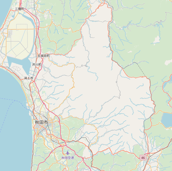
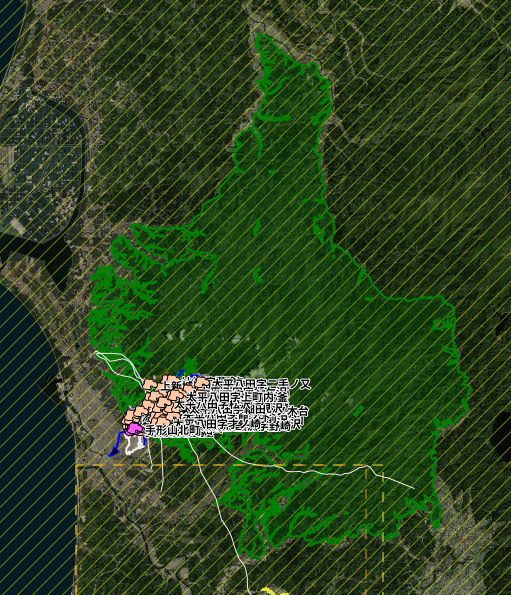
Please have a look at this: You see the big white space north and west of 秋田市. This used to be wood and as far as I remember it was correctly rendered yesterday/the day before yesterday. I checked in JOSM, and the wood relation seems to look fine: Any idea how this happened and how to fix this? I looked through a lot of changesets, but I couldn't find anything matching (maybe this, but probably not). If you can't have a look at the data but have some hints I'd be grateful too. (If you know a method how to properly search and display changesets it would be a big help too (I am using the history feature of osm.org which is quite inconvenient + changeset_viewer plugin of josm)) asked 06 Jul '19, 12:20 bkn_jap edited 06 Jul '19, 12:20 |
One Answer:
I believe we're talking about relation 5200043? JOSM's validator did highlight a geometry error: This inner way is intersecting the outer boundary of the multipolygon. The intersection seems to have been introduced as part of changeset 71024940 (osmcha). I'm not sure if this is actually the issue causing it not to be rendered, the change happened almost a month ago. It's worth correcting in any case. answered 06 Jul '19, 14:38 Tordanik |
Thank you, I fixed the issue and it's starting to render correctly (at least at high zoom levels for now).