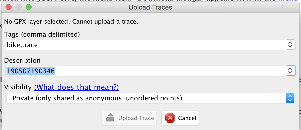
I'm using https://wiki.openstreetmap.org/wiki/User:Subhodip/GSoC_Doc#DirectUpload_Plugin_in_JOSM_: to upload my GPS trace in my JOSM. But I'm getting the following error -
Can someone guide me on activating this GPX layer in OSM? asked 07 May '19, 15:40 gps_trace |
One Answer:
If you have a GPX file on your hard disk, you just have to open it JOSM, via "File - Open" from the menu bar. If you already have a GPX file opened in JOSM, then you can use that plugin to upload the file to the OpenStreetMap servers. The reason to do this is that others might use your trace as well (if you make the trace public) So you "open" a GPX file in JOSM, you do not upload a GPX file to JOSM. The reason for this wording is that JOSM is a local program (or app), not something running on a remote server. Hope this helps. answered 09 May '19, 04:37 escada yes. that helped. I was assuming that that plugin helps in uploading GPX on OSM layer. (09 May '19, 08:32) gps_trace So, I want to plot a layer of GPX on OSM layer. Can JOSM do that? I've opened both layers in JOSM but unable to plot them one over another. Suggestions? (09 May '19, 08:35) gps_trace Do you mean something like this: /upfiles/Screenshot_2019-05-09_at_16.31.20.png where the white line is your GPX track ? (09 May '19, 15:32) escada 1 It is recommended to manually trace the GPX-trace, as it might contain unwanted spikes, e.g.near high buildings or under trees. You will also have to connect the path/road to the existing road network. You can take a look at this forum post, to learn how you can convert a trace to OSM data. But please, do improve the data manually before uploading. (10 May '19, 06:23) escada Actually, I've cleaned the tracepoints and built a logic to identify the missing roads in OSM data. So, now I want to visualize those new road points on OSM layer and fix the minor glitches whatsoever left and submit that data to OSM. Any suggestions on how to go about that? (10 May '19, 08:51) gps_trace Did you read the forum post? Is the suggestion made there not working? (13 May '19, 07:11) escada showing 5 of 6 show 1 more comments |
Do you have a gps trace open in your layers as described in that linked wiki page:
"Note : If you have multiple gpx layers in the layer list then the gpx layer which is currently selected in the layer list will be uploaded (it doesn't matter which one is the active layer)."
GPS trace is what i'm trying to upload here. There is nothing open in the background.
The plugin needs something to upload. I think the instructions are missing a critical first step: "Open the GPX file"
To make sure we are talking about the same thing (because you did not really answer to my question): You do want to upload a GPS trace to the openstreetmap server, don't you? Or do you simply want to display it in JOSM? That's done by <file> menu - <open>.
Oh! I misunderstood the purpose of this plugin. Plugin is used for uploading GPS trace to OSM remote. not to edit it locally.