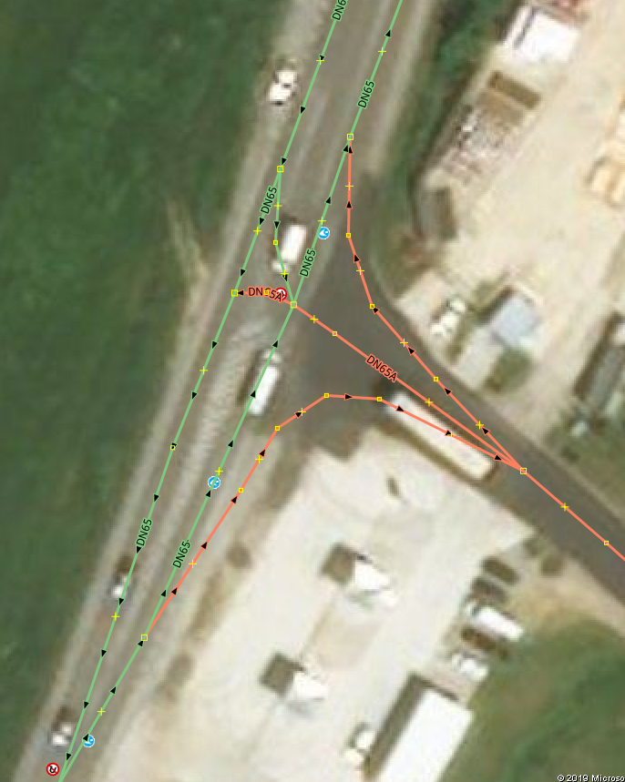
Hi OSM people! I've been editing roads in Europe and noticed that there a lot of *_link cases mapped as separate ways even though there is no physical separation between the lanes - only painted lanes on the ground. I understand that this can be mapped as a singleway with turn:lane information but there are a lot of link cases where that are only paint divided, and I don't want to modify them without making sure that physical separation is mandatory for links (can't seem to find that information on OSM wiki) Example this intersection in Romania: OSM geometry: asked 12 Apr '19, 11:19 Armin Gheorg... edited 12 Apr '19, 11:26 |
 Street level imagery from Mapilary:
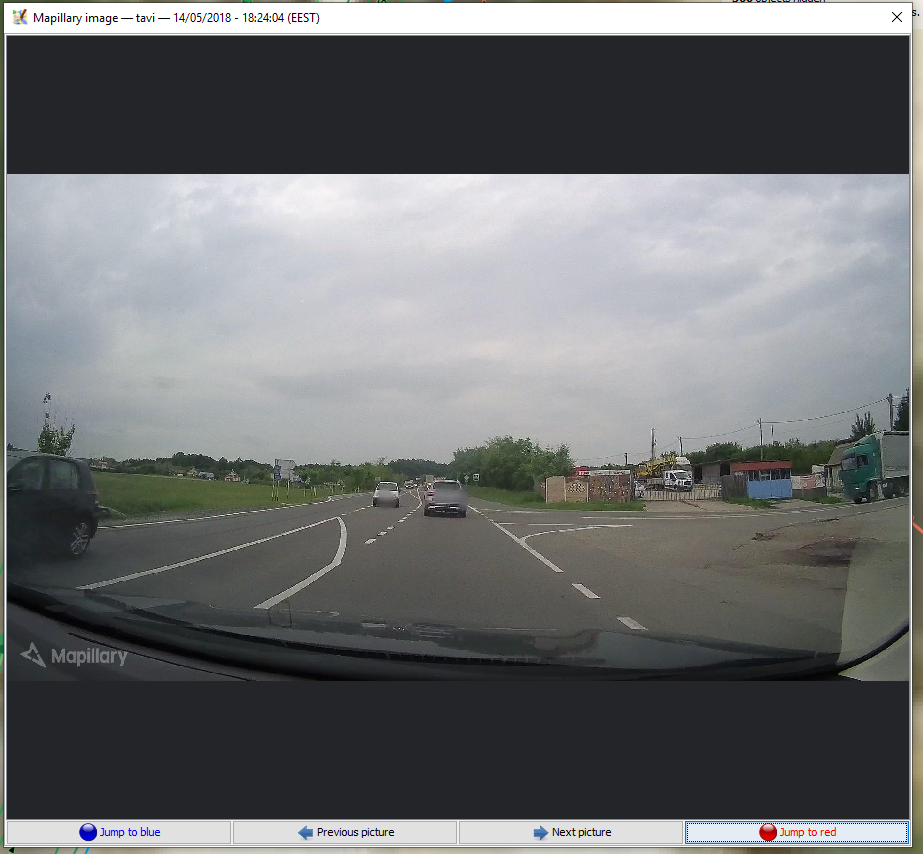
2 Answers:
Well, nothing is really mandatory in OSM. But there are certain conventions and reasons for those. You are right, if there are no physical dividers one should not map different ways, let alone using *_link. Routers and turn-by-turn navigation will not be able to give correct directions on this intersection. They are likely to say something like "take the exit to the right" instead of "turn right". On the other had it is good practice and conduct to get in touch with the local community before changing things like this, especially if you are doing it remotely. You can contact the original mapper via changeset comment and ask for their reasons to map the intersection like this. answered 12 Apr '19, 12:42 TZorn |
In some cases, communities do not add physical dividers that others would. Removing an extra way would result in routers issuing bad directions, such as the southbound from Reid School Road to Edwards Mill Road in this example. So it can be acceptable to create a separate way without a physical divider. answered 13 Apr '19, 11:48 Mike N edited 13 Apr '19, 21:22 |
I fully aggree. I see no reasons for this separation. It increases data complexity, possibly introduces additional errors (forbidden u-turns), leads to wrong navigation instructions and makes correct lane tagging hard/impossible.