I already know how to show a single GPX recorded track in iD editor. Either by loading the file in the editor "map data" section under custom map data, or by clicking "edit" on a track I uploaded into my account. The problem is I can only do it for one GPX track at a time. FLASH based Potlatch could display several tracks simultaneously, allowing me to select which ones to display. How can I do this in iD editor, explicitely loading and showing multiple user selected GPX tracks? Joining tracks with external program prior to upload is not a viable answer. Thank you. asked 04 Feb '19, 13:23 andrixnet |
2 Answers:
I think the answer is "you can't". See the links from here. This answer is marked "community wiki". answered 04 Feb '19, 13:45 SomeoneElse ♦ |
answered 04 Feb '19, 21:24 andy mackey edited 04 Feb '19, 21:47 |
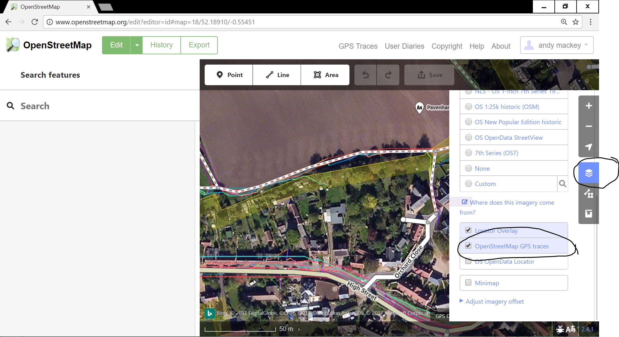 I just tried iD and it worked for me. Backgrounds: GPX traces. If this isn't quite what you wanted i think GPS prune will join several traces into one.
Yes - that does seem to be working again. There was a period when public traces either weren't appearing or were but only arratically, but here (turn the GPX layer on) there's exactly the trace that was walked just after Christmas.