I am trying to identify rooftops of all buildings for a part of a city. I have heard that we can do that in OSM. Can someone guide me how I can do it exactly? Once I identified the rooftops, I'd like to export the data and use it in QGIS to finish the rest of my project. asked 22 Jan '19, 19:53 Zakia110 edited 24 Jan '19, 20:20 aseerel4c26 ♦ |
2 Answers:
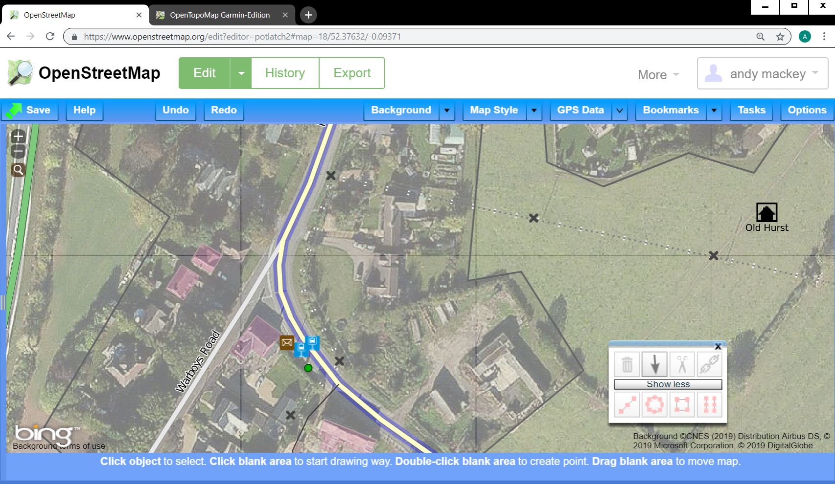
The JPEG above shows the Potlatch2 editor in use with Bing ariel selected. If the surrounding streets have been mapped and if you survey the area it is easy to recognise each building from above. Some of the buildings here have been mapped. This JPEG is zoomed out a little to give a bigger view. When zoomed in most buildings will easy to draw around, occasionally the images will have cloud but usually images are good. Now you have signed up the next step is to learn to use one of the editors to add the rooftops you are interested in. Happy Mapping answered 25 Jan '19, 19:59 andy mackey |
Hi Zakia110, Please read these pages about 3D tagging of roofs in OSM. https://wiki.openstreetmap.org/wiki/ProposedRoofLines https://wiki.openstreetmap.org/wiki/Key:roof:direction https://wiki.openstreetmap.org/wiki/Simple3DBuildingsV1#Roof_shapes There might be more pages, search for 3D. Have Fun and Keep Mapping answered 27 Jan '19, 11:21 Hendrikklaas The established convention for mapping buildings' roofs in 3D is documented on the Simple 3D Buildings page. If roof shape tagging is what OP is interested in, I would recommend that page as a starting point. (27 Jan '19, 11:59) Tordanik |
What is the relation of your question to google maps? (you have added it as tag)What do you mean by "rooftop"? Do you mean the roof shape? The roof size?
Of all buildings? Of a special building?[updated the clarified bits - thanks for your edits]In addition to the questions posed by aseerel4c26, are you looking to add this data to the OSM database, extract existing data from the database, or something else? What's your end goal?
@Zakia110 you need to clarify - otherwise you will not get any (useful) answers.