I am looking for a Travel planning / Navigation Application for iOS that allows users to show certain POIs (filtered based on values) like churches and displays the service_times and / or openings_times values too (first would be good for church services, second for restaurant opening times). I tested a few applications, but none showed this POI info: CityMaps2Go, Pocket Earth, osmADN, OffMaps 2. Any idea what could do it? The Overviews here https://wiki.openstreetmap.org/wiki/Apple_iOS#Applications_using_OpenStreetMap and here https://wiki.openstreetmap.org/wiki/Comparison_of_iOS_applications do not have that details. asked 05 Jan '19, 12:07 klischka |
One Answer:
OsmAnd will show opening in the search and Open/Closed status when you tap on a POI if the information is present in the OSM data. You can also use "Open now" as a filter when searching (slider icon on right in image below).
I don't know about service times though, nothing is showing in the search, but I also haven't found anything near me that has the information in OSM. Note that I am using the Android version of OsmAnd, but it seems like an odd thing to be missing from the iOS version. answered 05 Jan '19, 12:58 InsertUser |

OsmAnd also shows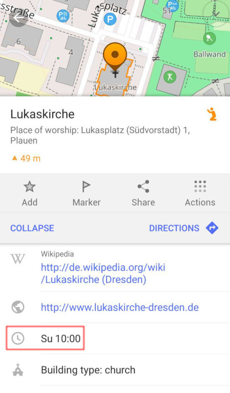
service_times, at least the Android app version: