Hello everybody, I was drawing the boundary lines of the tennis courts in Wimbledon. But I'm not really shure how to tag them. The net could be something like barrier=..., but the lines themselves - no idea. Anybody, who could help me? Thanks and regards René asked 28 Jul '11, 20:12 rene78 |
5 Answers:
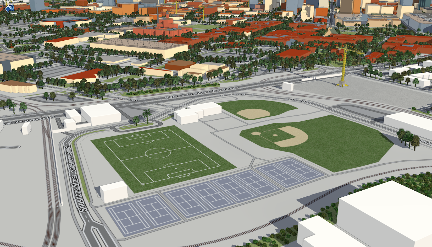
Example/Solution of 3D Rendering of Pitch Areas in F4map.
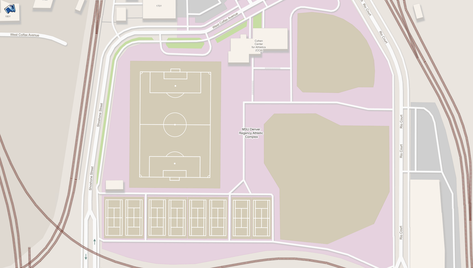
2D Tile map of Pitch Areas in F4map.
This is what the pitch areas look like when individually mapped with a simple rectangle, excluding the baseball fields. The soccer and tennis courts are just squared rectangular areas. The baseball fields were done manually as it's more logical than the other courts because every baseball field is always different. Also, please don’t Tag for the renderer, instead try find a related sport proposal that has tags listed and use them as a placeholder to be ready if they actually get accepted to render, most likely in zoom > 19 or 18. Image location at W Colfax Ave 80217 Denver, United States of America using F4map. answered 23 Dec '17, 04:29 Mxdanger edited 23 Dec '17, 04:30 |
To be honest, I think that mapping demarcation lines on a sport pitch is going too far, I wouldn't do that. What practical use does that have ? How are you going to handle multi-sport pitches ? What's next, demarcation lines of streets ? answered 29 Jul '11, 10:56 Vincent de P... ♦ 1 I think if he wants to map to this level of detail, he can go for it. The only thing is not many others will want to do it, so he's likely on his own as far as naming things. Also, this should probably go on the tagging@ mailing list, but I'd say use something verbose like tennis=net, tennis=boundary, and don't tag for the renderer (i.e. by (mis)using barrier=*). The verbose tags can later be renamed if consensus emerges on tagging these kinds of things. (29 Jul '11, 19:14) JoshD |
Given that all the lines within a tennis court are pretty standard, I'd have thought that simply marking the outer boundary of each court with rectangle marked sport=tennis, leisure=pitch would be sufficient. A renderer which has been told how to draw the details within a tennis court could then subdivide it as appropriate, putting the marking lines on based on the centre and orientation of the rectangle (in addition this would work for every standard tennis court in the world without any additional nodes/ways needing to be added to the main database). Otherwise, it just adds an awful lot of data that needs to be filtered out for normal applications. Drawing individual lines tagged as highway=path as you have currently done is definitely wrong though... the only person who would go along this "path" would be the one who paints the lines, and I doubt [s]he'd be using OSM data to determine where [s]he needs to go. I see that they are already within an area tagged correctly, but that some of the areas cover several courts. You could subdivide these (as with tagging individual buildings in a terrace) so that you have one area per court, and perhaps find appropriate details of the standard dimensions of a tennis court and propose an enhancement to your favourite renderers giving details of how a tennis court "should" be drawn. answered 01 Aug '11, 12:42 banoffee |
It might be useful to know the orientation of a court, where can I play across the setting sun? but otherwise I think drawing all the lines is excessive and wasteful of data storage and retrieval resources answered 02 Aug '11, 09:26 andy mackey |
While a principal of OSM is map everything, but I'm overwhelmed with aligning TIGER data to Bing and Yahoo imagery and getting the tennis courts and other pitches in 1st of all let alone each line on a sports field. In some cases I don't even define individual tennis courts when they are side by side, matter of time. answered 04 Aug '11, 16:38 Sundance |
This is more of a question for the tagging@ mailing list, but see my comment below Vincent's answer.