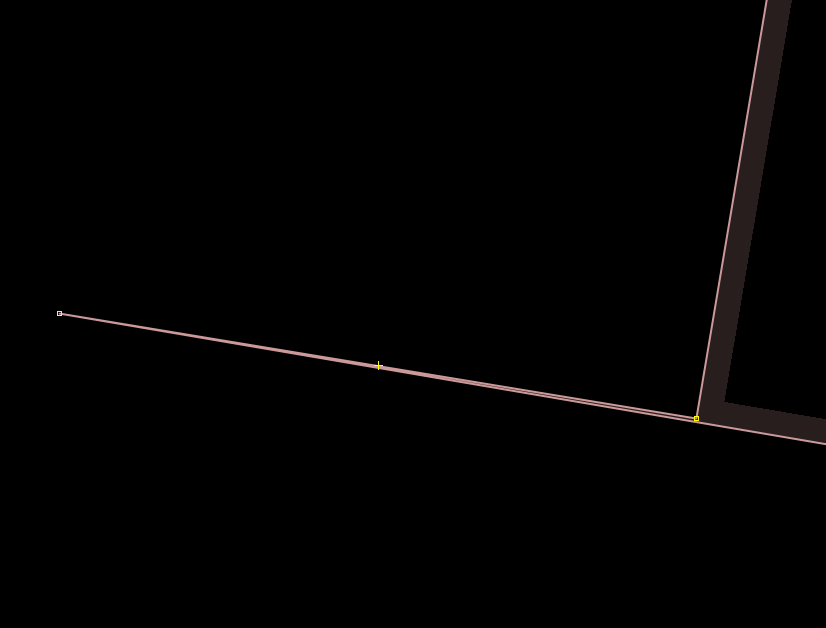
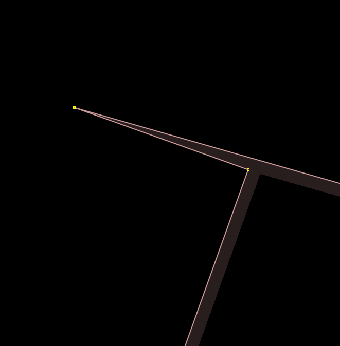
Hi everyone. I'm trying to fix several buildings having very sharp angles (see photos below), looks like they were unintentionally caused by the extrude tool in JOSM. It's hard to find them by eyes as they need to be zoomed very close to be seen. Is there a way to detect these using JOSM or another tool?
asked 30 Sep '18, 15:42 Privatemajory edited 30 Sep '18, 15:49 |
2 Answers:
While not the actual heuristic you are looking for, JOSM's validator would detect a "building with almost-right angle" info-level validation error for your examples. JOSM bug 15044 looks like wht you're looking for, but isn't implemented yet. answered 01 Oct '18, 01:01 Vincent de P... ♦ |
I am not sure how others are handling the issue but in most of the OSM maps the sharp angles (the spikes) are present. Besides the buildings the spiky configurations are present an other geometries like roads, roundabouts and so on. In almost all cases, spiky configurations are errors. Because of the maps' start scale, antialias rendering and object overlaps spikes are hardly visible and consequently they remain in the source indefinitely. At the same time, vector based GIS and map-makers should (and they do) have a tool to detect and remove spiky configurations. Actually, spikes are just special cases of tiny outgrowths created bay data generalisation while creating the scale/zoom levels (on fiords, peninsulas, tributaries and so on) and should be programmatically detected and removed. Therefor robust map-makers never see spikes in their maps. answered 17 Oct '18, 07:07 sanser Thanks @sanser for this! I'm no programmer, but perhaps your algorithm could be implemented in a JavaScript/Python script and be used on JOSM through the scripting plugin? If yes, I guess we're close to a solution. (17 Oct '18, 11:54) Privatemajory |
Yes, if "almost-right" angles are already detected, it shouldn't be very hard for them to implement a detection of "almost-flat" angles too.
I believe MapBox did run such an algorithm on OSM data, but I'm not sure if all such bugs were surfaced publicly. I cant see anything in the most widely used debug/lint tools: Osmose & KeepRight. At least some of these features are known as kickbacks & spikes in GIS circles. It may be possible to find a suitable spatial validation tool which works with opensource software such as QGIS.