NOTICE: help.openstreetmap.org is no longer in use from 1st March 2024. Please use the OpenStreetMap Community Forum

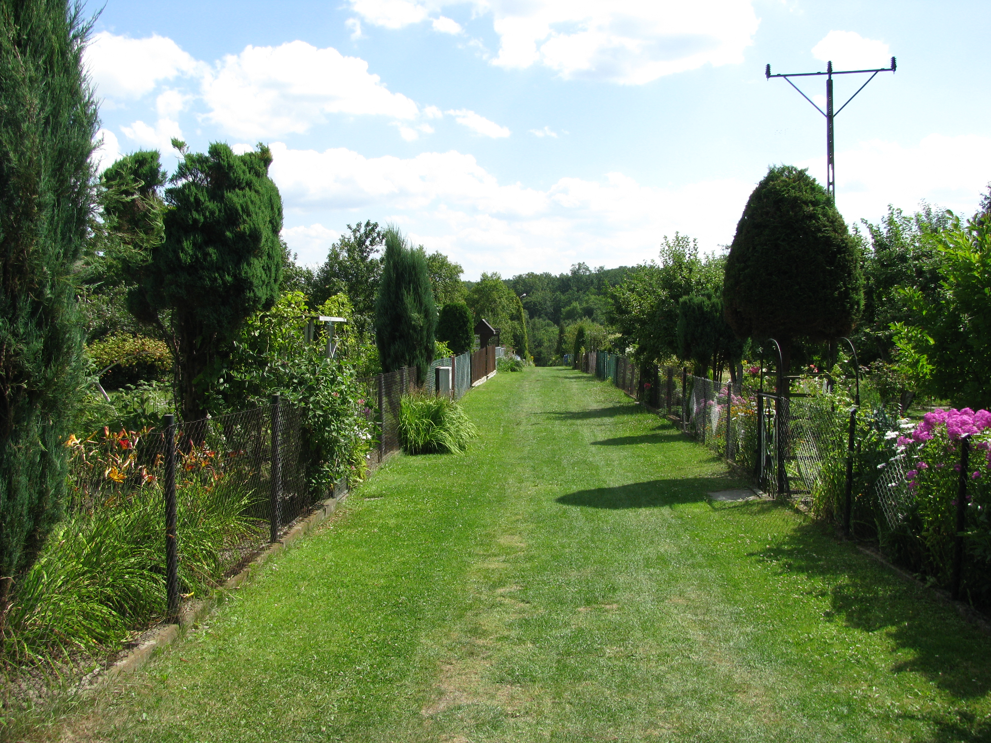
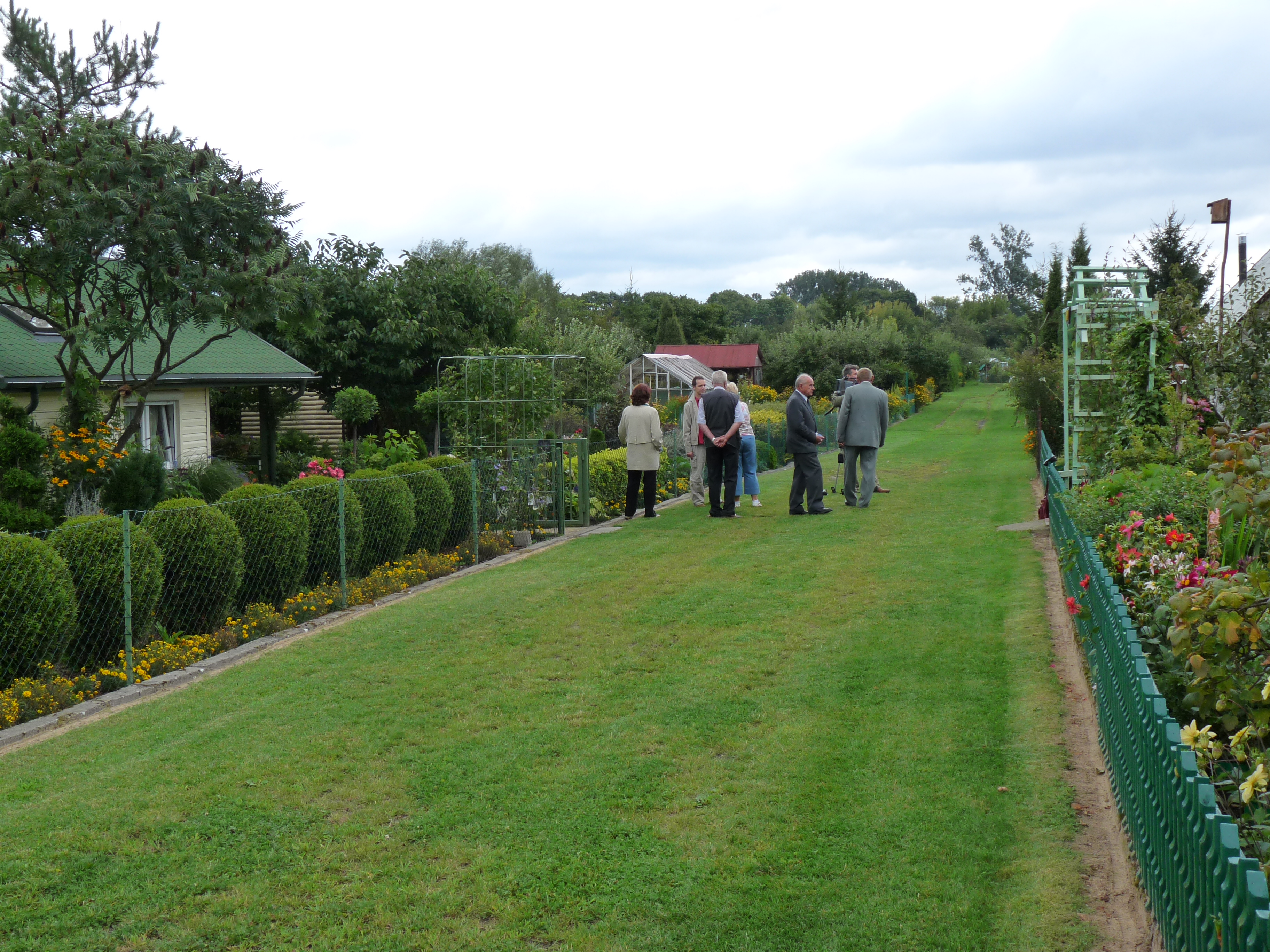
Hello! I'm rather new to OSM and I need a little help choosing the tags/type for a specific kind of path I'm having trouble categorizing. Here are the specifics:

  • These are paths within private garden allotments. But they're always open and non-members are allowed to walk through them.
  • A narrow gate at the entrance allows pedestrians and bicyclists access, but the gates are sometimes opened for cars if someone needs to bring something heavy to their garden.
  • Never seen snowmobiles, horses, or wheelchairs being used there.
  • Some paths are named and have signs like roads.
  • The surface type is mowed grass.
  • Example photos:
  • http://pzd.pl/uploads/images/1/IMG_2107.JPG
  • http://pzd.pl/uploads/images/P1040604.JPG
  • Region I'm working on.

Any help will be greatly appreciated.

asked 17 Sep '18, 00:12

Cambroulet's gravatar image

Cambroulet
25348
accept rate: 0%


Probably...

highway=track, bicycle=permissive, foot=permissive, motor_vehicle=private, surface=grass, name=(whatever the name is)

(you could make an argument for highway=footway instead, but the width seems to merit =track to me. There are some Maoists out there who will suggest highway=path)

permanent link

answered 17 Sep '18, 12:59

Richard's gravatar image

Richard ♦
30.9k44279412
accept rate: 18%

edited 17 Sep '18, 13:01

1

Certainly these are tracks in UK allotments, always wide enough to allow a vehicle in, even if they are used rarely for that purpose. tracktype would also be a tag to condiers.

(17 Sep '18, 13:44) SK53 ♦
1

Thank you Richard, this answers my question.

(18 Sep '18, 14:05) Cambroulet

Follow this question

By Email:

Once you sign in you will be able to subscribe for any updates here

By RSS:

Answers

Answers and Comments

Markdown Basics

  • *italic* or _italic_
  • **bold** or __bold__
  • link:[text](http://url.com/ "title")
  • image?![alt text](/path/img.jpg "title")
  • numbered list: 1. Foo 2. Bar
  • to add a line break simply add two spaces to where you would like the new line to be.
  • basic HTML tags are also supported

Question tags:

×163
×95
×8
×2

question asked: 17 Sep '18, 00:12

question was seen: 1,642 times

last updated: 18 Sep '18, 14:05

NOTICE: help.openstreetmap.org is no longer in use from 1st March 2024. Please use the OpenStreetMap Community Forum