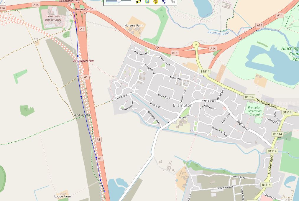
The slip road here https://www.openstreetmap.org/#map=16/52.3274/-0.2448 has been closed ( 7th jan 2018) and leaves the northbound A1 a mile earlier. It's easy to miss so i have mapped it although it will change during construction ( until December 2020 ). I will, I hope, be able to keep the map up to date during the project. Or should i just leave until it all done? I have displayed OSM using Prune with a blue gpx of my drive through the new route of the slip road. I also checked the trace illustrated (garmin oregon) by using another trace recorded at the same time with a motorola android smartphone that was also recording the route at the same time, there wasn't much difference. asked 15 Jan '18, 10:56 andy mackey edited 19 Jan '18, 13:19 |
One Answer:
The decision whether to keep up with construction updates is subjective, and depends on what access you have. Anything that can be verified is fine, even though it would require restricted access to the construction site (via a worker or special permission) or a refreshed view on OpenAerialMap. Locally I have subscribed to a daily work notice for an interchange construction zone and when I see announcements of a changed exit or slip road, I drive to acquire a new GPS trace and update accordingly, but haven't sketched any highway=construction. Map data consumers have their own update rate and the changes will appear later. answered 15 Jan '18, 13:09 Mike N Thanks, I only have normal public access. I will only add the roads and slips as they change and get used. The dotted construction roads have i guess been mapped from Highways Authority plans and leaflets circulated in the run up to the project approval and construction starting. This info was studied and compared to Bing, DP and existing OSM and visual from the side lines to generate a representation as best we all could of what the project will do. (15 Jan '18, 13:36) andy mackey Note: The slip road at the moment snakes through and across quite a few new lanes so will not represent the final slip at all. Which should explain why it doesn't align with the proposed road lines that you may see mapped. (19 Jan '18, 13:27) andy mackey |
This is Prune. https://activityworkshop.net/software/gpsprune/
Given the length of time & the complexity of A14 update works, it will probably be worth trying to keep OSM in step with the current situation. Unfortunately there aren't good ways of co-ordinating input from the, no doubt, many mappers who pass along the A14 & A1.
I am impressed with the way the A14 project is being done. Here the bridge was built plus the roundabouts and lead in roads and it was "switched on* overnight, insidentley this is a place where the road was made less straight all the other bridge roads seem to get straightened. But this one is based on the Romans Ermine street which was already straight! https://www.openstreetmap.org/#map=17/52.29209/-0.14833