Hi. I'm new to OSM, searched the FAQ and other questions here before asking this one. I am looking at the map of an estate surrounding a local hospital - the site is only a 10 minute walk from my home, and I've noticed that the map is displaying the wrong name for one of the streets - I tried to change the street to give it its correct name, and can't. I can add things around it, draw lines and stuff, but it won't let me change the name. The street name is listed as "Cunning Road" in Ely, Cambridgeshire. It's actually "Gunning Road", and it's part of a former RAF Military installation. Can someone please help me figure out how to change this, or simply go ahead and change it for me? There's plenty of refs on Google to the place and I can even go photograph a street sign as proof :) Thanks! asked 01 Jan '18, 11:03 SoHotImCool edited 01 Jan '18, 11:07 |
3 Answers:
I assume you have signed in and created a user name. Next zoom right in to where you wish to edit. (you need to zoom in or you will be trying to download a lot of data). Click on Edit and choose an editor. The iD editor will be good for small edits. Click on the street to highlight it, click on the name to edit it. change the name. save it, give the source of the name in your case local knowledge. save it Job Done may take a little while for the change to be seen at all zoom levels. note: it it easier to point to place by right clicking the map, centering it. them just copy the URL and paste it like this. https://www.openstreetmap.org/#map=19/52.41462/0.27820 answered 01 Jan '18, 12:25 andy mackey edited 04 Jan '18, 22:38 Opps Welcome, Happy New Year and Happy Mapping (01 Jan '18, 12:28) andy mackey (01 Jan '18, 12:31) andy mackey |
Hi and Welcome to OpenStreetMap, I see you've not as yet made any additions to OSM. Please go through the beginners guide before trying to do any edits https://wiki.openstreetmap.org/wiki/Beginners%27_guide then there's more chance of getting things right first time. In the meantime I've changed that road name for you, it is listed as Gunning Road on OS Streetview. Take your time getting started, If you need help give me a shout or shout on here. Regards Bernard answered 01 Jan '18, 13:57 BCNorwich 1 Sorry, hadn't realised Andy was answering. (01 Jan '18, 14:00) BCNorwich 1 No problem BC, but I was hoping the new mapper would do his first edit. (01 Jan '18, 16:44) andy mackey |
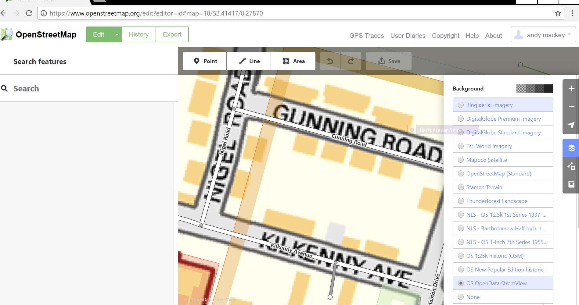
This is a screen grab of iD running. It show how and where BCNorwich gets openstreetview as layer in ID from. This data is an allowable source as well as all of other backgrounds that can be displayed in the editors. answered 01 Jan '18, 16:52 andy mackey edited 01 Jan '18, 16:55 |
What PC and editor have you tried, where did the process fail? NOTE: For copyright reasons OSM cannot use Google or many other maps for sources of information.
Thanks for that guys. I've had a look through the guide as BCNorwich suggested, and it's been a gem. The best editor for me turns out to be Potlach 2 - I've got some IT experience and it looks to be one I can get along with. I've made some edits and it appears to be working well. Many thanks for your assistance, and I hope to be here for a long time :)