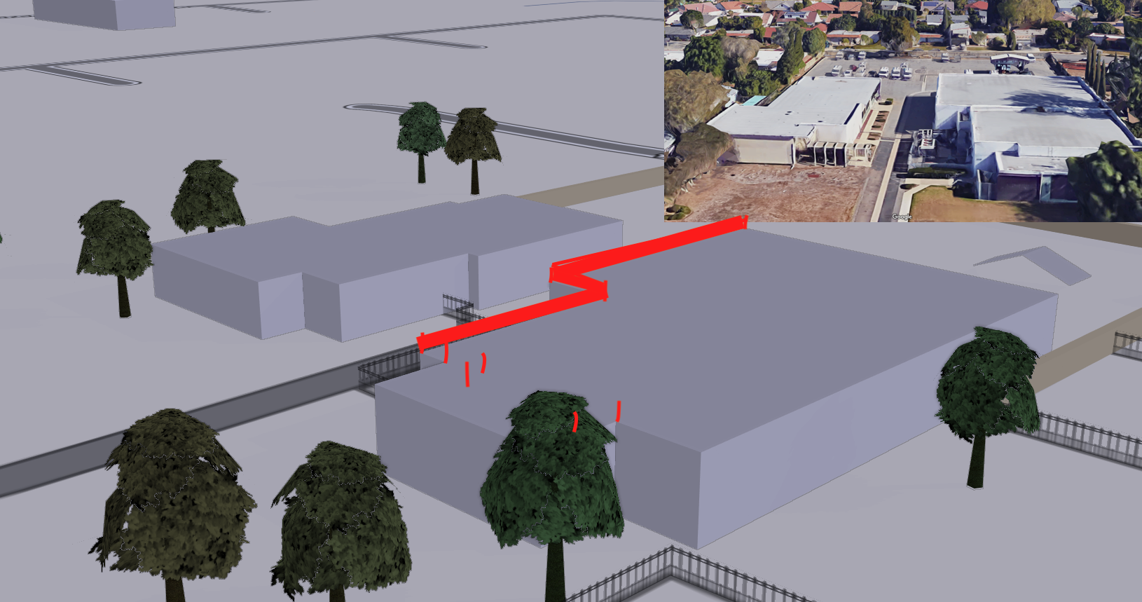
Anyone know how to add a parapet to a building with
asked 15 Dec '17, 15:11 Mxdanger edited 15 Dec '17, 21:31 |
2 Answers:
You simply create a wall and add a "height" value. A wall might even accept a colour for rendering, but I can't recall if that works or not. A min height will be necessary as well. answered 16 Dec '17, 09:43 chachafish |
You can also add molding that juts away from a wall, if you like. For an example of both, look here: http://demo.f4map.com/#lat=39.7534105&lon=-105.0000761&zoom=21&camera.theta=70.554&camera.phi=34.034 answered 16 Dec '17, 09:51 chachafish I use that f4map and it’s my favorite 3D web map. That location is perfect and all the detail is great for a great example! :) (16 Dec '17, 21:16) Mxdanger 1 Other items such as air conditioning units and pipes can be added to a roof as in this example: http://demo.f4map.com/#lat=39.7445699&lon=-105.0011002&zoom=20&camera.theta=61.845&camera.phi=-10.943 (17 Dec '17, 03:34) chachafish 1 Also, here you can see extensive roof elements along with a road tunnel through a building: http://demo.f4map.com/#lat=39.7432091&lon=-104.9905629&zoom=20&camera.theta=66.371&camera.phi=-81.417 (17 Dec '17, 03:41) chachafish I wonder why Denver has so much detail, not even New York has that much concentrated detail. (24 Dec '17, 06:38) Mxdanger I haven't found another city in the world which has better detail, but I'd love to be directed to one if one exists. (24 Dec '17, 07:09) chachafish My area is barren of buildings and detail but with every building I add I give it full attention to 3D tags and colors. It’s looking quite good but taking tons of time since I can’t get the Kendzi3D plugin to work in JOSM. (24 Dec '17, 07:42) Mxdanger showing 5 of 6 show 1 more comments |


Can min floor height be used for the bottom? Or is it best to just use the default floor height in meters as the min height?
You can specify height and min height as well as level and min level.
There should be some kind of indication that the wall is part of a building, such as
location=rooftop. Lifting the wall a certain height above the ground with min_height would only work if you assume flat terrain. Otherwise, the ground might be higher or lower below the parapet than other parts of the building, which would result in the wall hovering above or sinking into the roof. If the renderer knows that this wall belongs to the building, on the other hand, then its elevation can be changed in sync with the building.The only problem is if you use a line way with barrier=wall, it renders the width from the center (I suppose) so if you have the way directly attached to the area of the building, the barrier will not be flush with the wall of the building. Yes, F4map also renders the color of walls.