Help needed please with map editing from someone in the Lincolnshire area as there is an error on part of the river Witham map near Washingborough. asked 27 Nov '17, 11:54 KRB1 edited 27 Nov '17, 19:45 aseerel4c26 ♦ |
3 Answers:
This problem is on the Open Cycle Map. Assuming that the black mark across the river Witham represents a bridge, there are two. The one in Washingborough itself joins on to the main road which goes through the village. This is correct. There should be a bridge (it's a pedestrian/cycle bridge) over the Witham at the end of Five Mile Lane, but the Open Cycle Mapmap shows it to be further along the river towards Ferry Hill. The bypass plan over the Witham has indeed been going on for many years. It has just been started but it will be many months before it is finished. answered 30 Nov '17, 11:56 KRB1 1 If you go to https://www.openstreetmap.org/#map=14/53.2236/-0.4783 you should see a map of Washingborough. If you press the second button up at the right-hand side a blue marker will appear - drag that to the place where the bridge is and add some text saying that there's a missing bridge there. (30 Nov '17, 12:02) SomeoneElse ♦ 1 One more thing - the "black mark" at https://www.openstreetmap.org/#map=14/53.2237/-0.4787&layers=C doesn't represent a bridge. If you zoom in https://www.openstreetmap.org/#map=18/53.22578/-0.48110&layers=C you can see it's a National Cycle Network signpost, specifically this one: https://www.openstreetmap.org/node/663977736 . OpenCycleMap tries to show these signposts using an icon representing their actual shape. (30 Nov '17, 12:22) SomeoneElse ♦ |
KRB1 as put a note on the bridge, as suggested by SomeoneElse. The bridge does not have a cycle allowed tag answered 30 Nov '17, 14:45 andy mackey edited 30 Nov '17, 14:47 https://www.openstreetmap.org/way/442850075 is a cycleway - it really shouldn't need a bicycle=yes tag for cycle renderers or routers to recognise it (and I do see it on opencyclemap, which is why I wondered whether some other map or app is involved) (30 Nov '17, 14:50) SomeoneElse ♦ I'll leave the error for a short time so it can be looked at, I'll fix it tomorrow unless it's been fixed by someone or even SomeoneElse:) (30 Nov '17, 14:52) andy mackey Does the bridge in question not appear on a cycle map for you? Do other bits of cycleway that don't have a bicycle=yes tag appear on the same map? I'm not convinced there's an error here yet. (30 Nov '17, 15:06) SomeoneElse ♦ OK thanks. (30 Nov '17, 16:34) andy mackey |
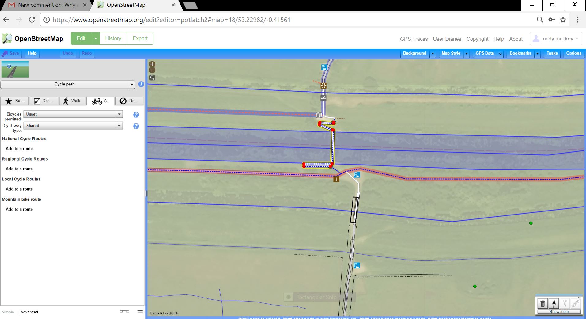 which is why it doesn't get put on the cycle map. see pic
Hi Someone else, I am definitely using the Open Cycle Map but having zoomed in I can now see the black mark is a cycle signpost on the Water Rail Way, not a bridge. I shall leave it for another more competent map editor to correct my contribution of the Five Mile Pedestrian bridge which is currently not accurate. answered 30 Nov '17, 16:01 KRB1 Unfortunately, I can't see what's wrong with it :) It looks pretty much as I'd expect from how I remember it when I was last there, and it's mapped as a cycleway, and appears as a cycleway on OpenCycleMap. What are you expecting it to look like? The only "different" looking cycleway there is the "Water Rail Way" on the south bank of the Witham - that's got a pink outline because it's part of National Cycle Network Route 1. (30 Nov '17, 16:09) SomeoneElse ♦ |
Can you edit your question and paste the url from https://www.openstreetmap.org of the part that is in error and can you also tell us what the error on part of the river is. We can then see how it is mapped and tagged and sort out the problem.
Perhaps you refer to only the centreline of the river being mapped and not the riverbank too in that section?
What's actually the problem? The Witham at Washingborough is at https://www.openstreetmap.org/#map=14/53.2221/-0.4758 btw (just move the map at the URL updates). I've not been there for about 4 years (https://www.openstreetmap.org/changeset/15982784 was the last time I think) but if you can describe the problem I'm sure we can help you fix it :)
Hi Someone Else, I should explain that the map I am referring to is the Open Cycle Map. I was sent to you from them. There are two bridges crossing the Witham near Washingborough. One is in Washingborough village and the other is at the end of Five Mile Lane where it crosses the river and goes into Fiskerton. The bridge on your map is further along the river. I don't find your site very easy to use but if you can tell me how to attach a scan to this email I can send a pic. Thanks, Kathryn
There are two bridges shown - there's the one at the end of Five Mile Lane, and there's the new eastern bypass one at https://www.openstreetmap.org/#map=16/53.2245/-0.5002 (assuming that construction on that has actually started - that scheme has been on and off for years).
Is the "new bypass" to the northwest of Washingborough the one that you mean or is there another cycle bridge somewhere to the north?
On the https://www.openstreetmap.org/#map=14/53.2237/-0.4787 site there's an "add a note to the map" button at the right-hand side - if you press that you can create a marker and move it to where the new bridge is.